
|
Home >
Settings >
Archives >
April 2021 >
Meet a GeoTech: Graffiquo
Meet a GeoTech: Graffiquo
Tell us about Graffiquo and its solutions
Graffiquo provides visual intelligence for easier decision making. We achieve this by unifying shareable information via open standards on a photo realistic 3D geo referenced platform.
Benefits and Use Case 1
We photo captured and modelled a 100km2 city council in Malaysia. With this model, we layered land cadastral information, city council own data on ownership, addresses and renovations completed. The city council uses our model to measure the renovation site and compare the plans submitted. With this information, they are able to calculate the property’s tax assessment. The benefits they gained from this are time and cost saving by not needing people to go onsite.
We photo captured and modelled a 100km2 city council in Malaysia. With this model, we layered land cadastral information, city council own data on ownership, addresses and renovations completed. The city council uses our model to measure the renovation site and compare the plans submitted. With this information, they are able to calculate the property’s tax assessment. The benefits they gained from this are time and cost saving by not needing people to go onsite.
Benefits and Use Case 2
This client in urban planning uses our platform as a shareable tool. Models and information that they would like to share with external organisations, for example property developers and architects are on our platform. Our client’s customers can log in from anywhere and see the same information as our client. The other feature that our client likes is that they can create their own videos (Graffiquo calls it tour) and ‘copy and paste’ the link on to any social media communication tool for example Whatsapp. Our client’s customers do not need sign in access to our software.
This client in urban planning uses our platform as a shareable tool. Models and information that they would like to share with external organisations, for example property developers and architects are on our platform. Our client’s customers can log in from anywhere and see the same information as our client. The other feature that our client likes is that they can create their own videos (Graffiquo calls it tour) and ‘copy and paste’ the link on to any social media communication tool for example Whatsapp. Our client’s customers do not need sign in access to our software.
What is something about Graffiquo that the general public might not know about?
Graffiquo is an Organization for International Economic Relations (OiER) partner. OiER manages the implementation of United for Smart Sustainable Cities (U4SSC) which is a United Nations (UN) initiative to achieve Sustainable Development Goal 11: "Make cities and human settlements inclusive, safe, resilient and sustainable".
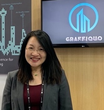
Goh Seok Mei, CEO of Graffiquo
What are some challenges you have faced in your work?
The challenge we face is trying to explain a very new and innovative solution and how this fit into multiple industries.
How has your experience with GeoWorks been?
My personal joy working with GeoWorks is how friendly and helpful everyone is – from opening up new opportunities and partnerships, supporting us in zoom calls, trying to co-exist our platforms, providing bright and conducive workspace to Rani’s smile as we walk into office in the mornings!
How does geospatial technology help you in your work?
Few years ago, no one’s heard about mobile navigation and when it was launched. I too was sceptical thinking that I already know how to go from point A to B. Imagine now, I rely on mobile navigation, not for directions, but for expected time of arrival, traffic conditions, mode of transport and shortest or alternate routes.
Are there any challenges that come with working with geospatial technology?
There are a few challenges:
- 3D photogrammetry (using photographs to ‘construct’ into a 3D model) – permits to capture via drones or helicopters,
- Scepticism and personal protection rights – ‘giving’ people location information,
- Getting the right skills and experience.
In your opinion, what skills are needed to work in the geospatial industry?
The skills that Graffiquo look for are very diverse: from software programming, understanding of geospatial databases, storing of multiple types of big data sets, managing cloud infrastructure, mathematics for AI algorithms, geography and understanding industry requirements.
Do you have any advice for aspiring entrepreneurs?
Come have a chat with me anytime. I am happy to share our ups and downs and I always believe that “Success is not a destination; it is a journey to be enjoyed”.