
|
Home >
SLA Products >
Licensed Data
Licensed Data
The Singapore Land Authority (SLA) is the trusted centre for authoritative government geospatial data in Singapore.
SLA offers geospatial data that are authoritative, accurate, granular, timely and localised via SLA products that include Licensed Data.
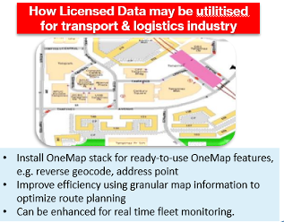
Licensed Data can be used in sectors such as transport and logistics for real time fleet monitoring.
The types of datasets available under SLA Licensed Data are:
• SLA Street Directory
• SLA Address Point
• SLA Digitised Cadastral
• Land Base Road Network
• Land Base Building Outline

Industry Use Cases
SLA’s geospatial products have been adopted in several sectors in a variety of ways. These are:
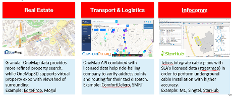
Real Estate:
• Granular data from OneMap offers refined property search
• OneMap3D supports virtual property expo with a view of the surrounding areas
Transport & Logistics
• The OneMap API, combined with Licensed Data, help ride-hailing companies verify their address points and routes for taxis
Infocomm
• Telecommunication operators integrate cable plans with SLA's streetmap Licensed Data for highly accurate underground cable installation
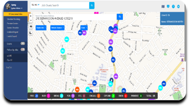
| Customer Case Study ComfortDelGro Taxi and SLA’s Licensed Data
Using SLA data to deploy taxis more efficiently during peak hours
|
Contact geoworks@sla.gov.sg to learn more.