|
Home >
SLA Products >
OneMap3D
OneMap3D
The Singapore Land Authority (SLA) is the trusted centre for authoritative government geospatial data in Singapore.
SLA offers geospatial data that are authoritative, accurate, granular, timely and localised via SLA products that include OneMap3D.
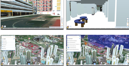
OneMap3D, a 3D format of OneMap launched in 2021, presents an immersive experience of the user’s surroundings. The platform has many applications including real estate, drone management and logistics.
Supporting digital transformation with 3D data
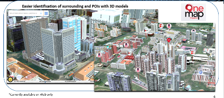
• The real estate sector is able to use OneMap3D for better representation of their properties in relations to their surroundings.
Additionally, property focused features will enable property buyers to make informed buying decisions. In our sunny island, sunshine and the facing of a property is a factor in the liveability of a property. The shadow feature assist users by showing them the movement of the sun around the property over time.
• Logistics and delivery services can plan for more reliable and accurate drone flight paths using OneMap3D. Drone deliveries will enable efficient delivery and supports delivery personnel by reducing the physical demands on them.