GeoWorks
Presents
Asia’s
First Geospatial-Focused Week in Singapore
Ten Leading
Companies to Organise Geospatial-Centric Events During
“Singapore
Geospatial Week”;
Over
1,000 Participants from Singapore and the Region Expected
Asian geospatial
professionals and enthusiasts will gather in Singapore for a week of exciting
geospatial-related events and activities, when Singapore Geospatial Week launches from 2 - 6 September 2019.
2. Presented
by GeoWorks, Singapore’s only geospatial-focused industry centre, managed and
operated by the Singapore Land Authority (SLA), Singapore Geospatial Week will feature five intense days of events
that celebrate and promote the importance and growth of geospatial technology,
applications and data in Singapore.
3. Geospatial
adoption will increasingly be an important
and critical component in Singapore’s development and redevelopment of its
infrastructure and industry. Ten leading companies will be organising
geospatial-centric events during the week, with over 1,000 geospatial professionals and geospatial
enthusiasts from Singapore and the region expected to participate in what will
be seen as Asia’s first geospatial-focused week.
4. Singapore Geospatial Week will be
anchored by a number of major events. For the geospatial professional, the week
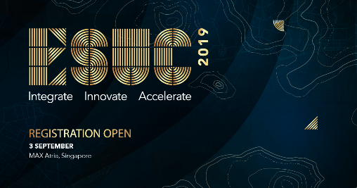
will feature the ESRI Singapore User
Conference, held at Max Atria at the Singapore Expo on 3 September 2019,
and the Location World geospatial
trade show and conference at Amara Hotel from 5 – 6 September 2019. In
addition, companies such as GRAB and communities such as MaptimeSG will be
organising geospatial mapathons and workshops that are open to the general
public.
5. GeoWorks
will also be organising the first Regional
Geospatial Youth Forum on 6 September 2019 at Amara Hotel, where young
professionals and students from Singapore and various ASEAN countries will be
able to showcase their projects and network among themselves. The event is
designed to highlight the creativity and innovation of the next generation of
young geospatial leaders in the region.
6. SLA
GeoSpatial & Data Director and Chief Data Officer Ng Siau
Yong said, “Geospatial technologies
have advanced rapidly over the last few decades, as the demands for smart city solutions
are growing due to the need to improve operational efficiency and manpower
productivity. The aim of Singapore
Geospatial Week is to generate a wider awareness of the importance of
geospatial technology in Singapore and the region, as well as to increase the
vibrancy of the local geospatial communities here, especially among the youth
and young professionals.”
7. Visit www.geoworks.sg for a full line-up of activities during Singapore Geospatial Week. (See Annex A
for Event Highlights)
GeoWorks Celebrations First
Anniversary
8. To
coincide with the launch of Singapore
Geospatial Week, GeoWorks will be celebrating its first anniversary on 2
September 2019. GeoWorks was officially launched in July 2018. GeoWorks aims to
connect businesses, entrepreneurs and innovators to drive geospatial solutions
for the promotion of business growth and opportunities in Singapore and around
the region.
9. GeoWorks
currently houses 26 geospatial scale-ups (GeoTechs) and have the support of 20
geospatial partners (GeoPartners). Out of the 26 geospatial scale-ups, about 54%
of them are local Singapore companies, with the rest coming from all over the
world, in many cases, entering the Singapore and Southeast Asia markets for the
first time.
10. Since its
launch, GeoWorks has hosted and/or organised over 280 events and activities, ranging
from regional business and technical workshops to local learning journeys for
schools and organisations.
11. GeoWorks
was set up by SLA as an initiative under the Singapore Geospatial Master Plan,
which sets out the vision towards a ‘Geospatial-Powered Singapore’. The aim of
the Geospatial Master Plan is to leverage on emerging technologies and to build
geospatial competencies to address complex challenges and create opportunities.
This is in line with the Digital Government Blueprint’s strategy to raise
Whole-of-Government’s digital capabilities to pursue innovation, in support of
Singapore’s Smart Nation Drive.
Singapore Land Authority
23 August 2019
Annex A – Singapore Geospatial Week Event Highlights
The Singapore Geospatial Week is presented by GeoWorks, a geospatial
industry centre operated and managed by SLA. During the week, there will be a
series of co-located geospatial and mapping workshops, sharing sessions and activities
for industry specialists, developers, enthusiasts or anyone seeking to learn
about the possibilities of location-based information and technology.
Below are the event highlights. Please check the GeoWorks website (www.geoworks.sg) for the latest programme line-up.
#GeoWeek events 2-6 September 2019 |
|---|
| ESRI
Singapore User Conference
Date: 3
September 2019
Time: 10:00
AM – 5:00 PM
Venue:
MAX
Atria @Singapore EXPO, 1 Expo Drive, #02-01, Singapore 486150
The ESRI Singapore User Conference is
Singapore’s largest geospatial event highlighting how GIS technology drives
achievements across a wide range of industries - locally and regionally. With
the theme Inspiring Outcomes, ESUC 2019 explores how GIS technology is changing
the way organisations operate and serve their communities today and for
generations to come.
This one-day event
features forward-thinking GIS users sharing their innovative solutions to
real-world problems and gives you a front-row seat to the future of Smart with
sessions on Living City Concept, Big Data and Analytics and Artificial
Intelligence. |

| Teh-Tarik
and English Tea Talk
Date: 3
September 2019
Time: 5:00
PM – 7:30 PM
Venue:
GeoWorks,
PSA Building, Level 7
In partnership with UK-based Ordnance Survey and its
incubation facility Geovation, GeoWorks will be hosting a Singapore-UK forum
for geospatial companies looking to explore entering the Singapore market.
Likewise, the forum is also geared towards helping Singapore geospatial
companies expand into UK and Europe. The event is supported by the UK Department
for International Trade.
|
 | Grab
Mapathon
Date: 4
September 2019
Time: 2:00
PM – 5:00 PM
Venue: 9
Straits View, Marina One West Tower, #23-07/12, Singapore 018937
Presented by Grab as a CSR initiative, Grab Mapathon
participants will map ramps and sidewalks infrastructure in Singapore for
improving accessibility for physically-challenged persons.
|
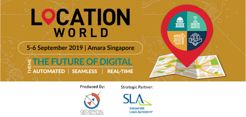 | Location
World 2019
Date: 5-6
September 2019
Time: 9:00
AM – 6:00 PM
Venue:
Amara
Singapore, 165 Tanjong Pagar Road, Singapore 088539 Location
World is a platform to promote and share best practices of location technology.
It brings together different industry genres under one roof to channel
knowledge, showcase the latest technologies and promote dialogue on the
challenges, opportunities and the future of location industry.
With the theme ‘The Future of Digital: Automated| Seamless| Real-Time’, Location
World 2019 will focus on the value of location technology in digital economy
and its integration with emerging technologies such as AI, IoT, 5G, cloud, etc.
The conference will focus on two major segments: Smart Cities and Business
Enterprises (BFSI, advertising, logistics & supply chain, retail, and
others). |
 | Regional
Geospatial Youth Forum (RGYF)
Date: 6
September 2019
Time: 9:00
AM – 5:00 PM
Venue:
Amara
Singapore & GeoWorks, PSA Building, Level 7
The RGYF will see young Geospatial
professionals from around the region gather and share their experiences through
a series of conversations, geospatial project showcase and interactive
workshops. Focusing on three key principles: Innovate digital solutions for a dynamic environment, Collaborate to address common issues and
Inspire the next generation of
Geospatial professionals - the forum aims to build a community of passionate
Geospatial champions. |
Geospatial
Talks @ GeoWorks Open House
Date: 6 September 2019
Time: 2:00 PM – 5.00 PM
Venue: GeoWorks, PSA Building, Level 7
Registration details: www.geoworks.sg |
 | Mok Ly
Yng: Curious Tales from Singapore Maps (Geospatial Talk)
Well-known speaker
Mok Ly Yng will be giving a talk on Curious Tales from Singapore Maps based on
his findings about Singapore historical maps over the last 20 years. |
 | Create
your own maps by MaptimeSG (Workshop)
Nowadays, everyone has access to geospatial
information and participate in creating a map. This process helps us
interact with our surrounding environment more in-depth, and understand the
space we live in. For example, you can learn about the trees you see at a park;
their name and characteristics through GPS and interactive map; you can also
report problems you see on roads (e.g. a cracked road, faded lane markings) and
share with the public. With many available digital tools and
applications, more and more people have become familiar with
geospatial interactions and enjoy the usefulness of it. How can we further
extend this concept?
In this workshop, the community-led MaptimeSG is conducting a two-hour
session to teach participants some of the basic skills to work with geospatial
data as well as ongoing examples of how this concept can be applied to a real
project in order to solve issues. Participants will also get the chance to gain
hands-on exercises to make their own map, tell the stories in the
neighbourhood to inform and inspire others. |
| | Creating and Validating Crowdsourced Data by Grab (Workshop)
Creating
crowdsourced data is an interesting process but to make sure that the data we
create is accurate, we'd have to validate them for their accuracy and correctness.
This workshop will focus on sharing points and tips on validating the data and
change-set we create with the community. |
 | OneMap Community Workshop with MOGUL.sg as guest speaker (Workshop)
OneMap is a whole-of-government mapping platform to help agencies deliver geospatial information and services. This workshop provides an introduction to how the OneMap platform was developed, its innovative and collaborative features and the variety of Application Programme Interface that developers can tap on to power their geospatial applications. MOGUL.sg, one of GeoWorks' GeoTech will join the workshop as a guest speaker and share their experiences on how they leverage on OneMap to power their smart property portal. |
 | Banded Langur Working Group
Understanding
how the Banded Langur Working Group use geospatial tools for the conservation
of the critically endangered Leaf Monkey. |
 | LDR LocoMole Augmented Reality Map Trails
How to
transform learning and experiences using geospatial technology and mobile
experiential applications. |
 | Hexagon Geospatial
Visual
Analytics: How the way we visualise the environment around us can augment the
human. |


.png)