
|
Home >
Settings >
Archives >
March 2020 >
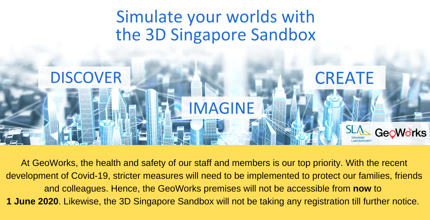
Singapore Land Authority Launches 3D Singapore Sandbox at GeoWorks
Singapore Land Authority Launches 3D Singapore Sandbox at GeoWorks
March 23, 2020
For the first time, nationwide 3D geospatial data will be made available for testing innovative solutions
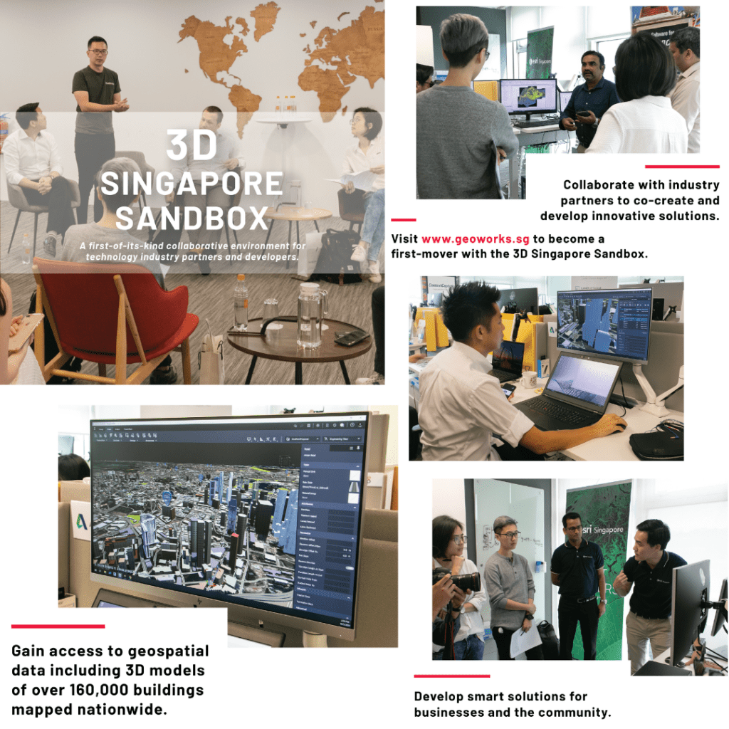
Singapore Land Authority announces the launch of 3D Singapore Sandbox today, a first-of-its-kind collaborative environment for technology industry partners and developers. This initiative aims to encourage the use of 3D city models and geospatial data to develop and test new applications and services that can benefit both the public and private sectors.
The 3D Singapore Sandbox is open to industry partners who wish to leverage 3D geospatial data to support better decision-making, and to develop smart solutions to drive operational efficiencies and value for business end-users.
“We believe the global geospatial industry is set to undergo a major transformation from 2D to 3D in the coming years. By making available 3D city models that we have built, as well as other geospatial data through the Sandbox, we hope innovators, entrepreneurs, industry partners and the technology community can develop and test new services and solutions that will add to Singapore’s effort in becoming a smart city,” said SLA GeoSpatial & Data Director and Chief Data Officer, Mr Ng Siau Yong.
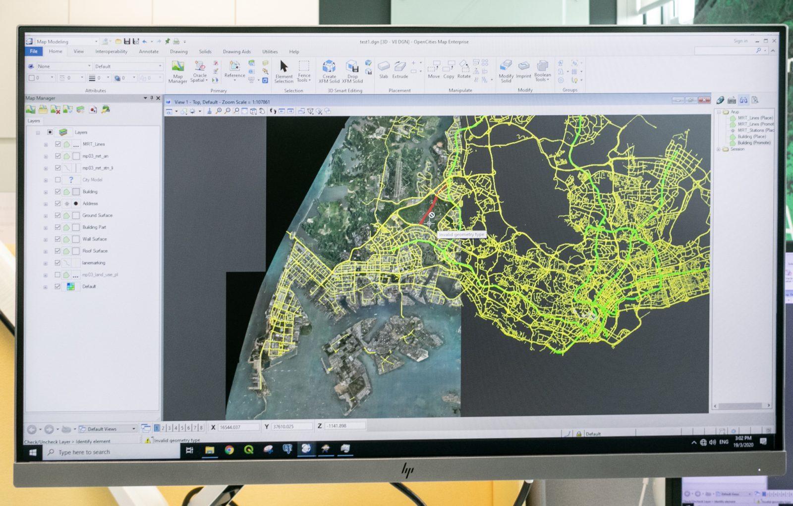
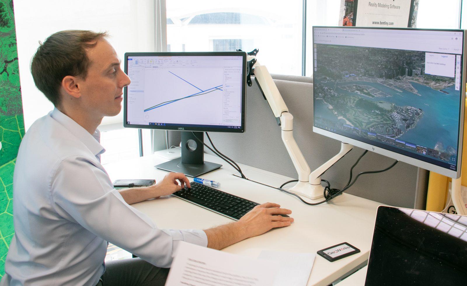
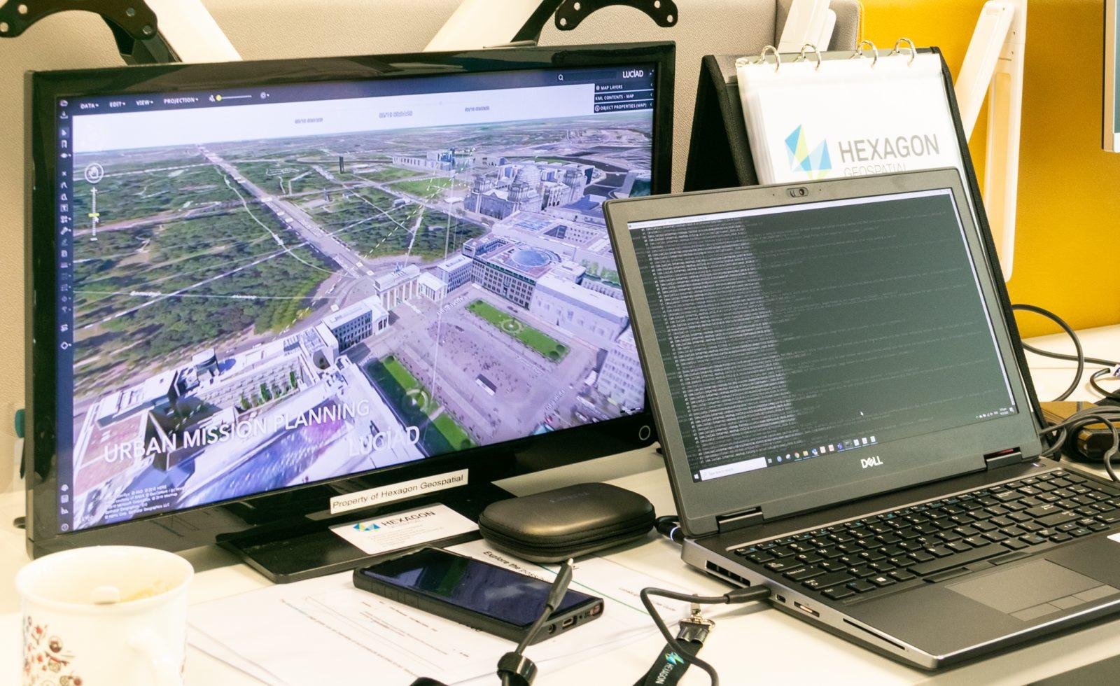
The Sandbox will provide users with access to SLA’s 3D geospatial data including 3D models of over 160,000 buildings mapped nationwide. Users will also have access to geospatial solutions provided by established industry partners Autodesk, Bentley Systems, Esri Singapore and Hexagon Geospatial. On top of that, SLA has collaborated with global data analytics provider LOTaDATA to provide access to “people movement intelligence” data for geo-analytics.

Businesses in the architecture, real estate, construction and logistics industries are identified as potential first movers. They are encouraged to leverage the Sandbox to collaborate with industry partners to co-create and develop innovative solutions to enhance their business operations and processes. For example, real estate developers could use the Sandbox’s 3D geospatial data, models, and tools to visualise how their new building construction would synergise with the surrounding urban environment to improve overall livability for the neighbourhood.
The Sandbox is located at GeoWorks, the geospatial industry centre first set up by the Singapore Land Authority (SLA) in 2018 to promote business growth, drive innovation and foster a well-connected community of geospatial firms.
GeoWorks currently hosts 42 companies, otherwise known as GeoMembers, which consist of a combination of geospatial scale-ups and large established geospatial organisations. These GeoMembers come together to share and build expertise, network access, and business opportunities for the whole geospatial industry.
Businesses interested to use the 3D Singapore Sandbox can visit www.geoworks.sg/3d-singapore-sandbox for more information.
Matthew Dewees
ASEAN Head of Architecture, Engineering, & Construction
Autodesk
“We are delighted to support the Singapore Land Authority in its ongoing efforts to build a more liveable environment in land-scarce Singapore through digital transformation. With Integrated Digital Delivery (IDD) a key thrust in Singapore’s Construction Industry Transformation Map, I am confident that Autodesk solutions can improve infrastructure planning and design sustainability through better collaboration and workflows. We have supported many organisations on similar journeys and are committed to continue helping SLA achieve its goals.”
Kaushik Chakraborty
Vice President – Southeast Asia and India
Bentley Systems
“Bentley systems is pleased and proud to join Singapore Land Authority’s 3D Singapore Sandbox initiative, to collaborate with the infrastructure ecosystem partners in delivering value to the citizens. As a forward-thinking nation, Singapore has always pushed the boundaries in terms of setting up best-in-class infrastructure across transportation, utilities, housing, etc., to improve the quality of life for its citizens and residents. With our global experience in working with users that design, build, and operate infrastructure, we are looking forward to actively contribute to this initiative.”
Thomas Pramotedham
CEO
Esri Singapore
“The Singapore Land Authority continues to lead efforts to leverage geospatial technology and practices – to continuously discover and expand space possibilities within the country. As a long-time partner, Esri Singapore is proud to be part of this ongoing collaboration to drive geospatial innovation through the offering of an open and interoperable platform within the 3D Singapore Sandbox. We hope to continue making progress through this enduring partnership towards building geospatial competencies for Singapore's future.”
Dirk Wagemans
Vice President, Asia Pacific
Hexagon Geospatial
“Hexagon is committed to putting data to work to make cities safer and more sustainable. We are honoured to be part of the Geowork’s Sandbox initiatives, where different organisations can leverage our cutting-edge location intelligence solutions, connecting to different information and interactively visualise and analyse all these information to drive real-time decision making.”
Apu Kumar
CEO
LOTaDATA
“LOTaDATA invented 'People Intelligence' in 2017. Our fresh, accurate, anonymized, daily crowdsourced mobile datasets about people-presence, activity, and movement, are available for 1450 cities and metro areas worldwide. We are delighted and honored to be part of the GeoWorks family at the Singapore Land Authority, by joining forces with SLA, we have made our datasets accessible to the geospatial community to solve real-world problems ranging from urban planning, mobility, transportation, economic development, public health, and disaster resilience.”
Read our article in The Straits Times here: https://www.straitstimes.com/tech/nationwide-geospatial-3d-data-made-available-to-businesses-for-first-time-in-sla-initiative