
|
Home >
Settings >
Archives >
June 2020 >
MND Centre of Liveable Cities – Modelling a New Normal: Social Distancing’s Impact on Land Use
MND Centre of Liveable Cities – Modelling a New Normal: Social Distancing’s Impact on Land Use
June 12, 2020
With COVID-19 upending our lives, what would cities look like in the near future? How does new behaviour such as social distancing affect intercity rail and train networks, road systems, and public transport? Will cities expand or shrink, and what would new urban densities look like?
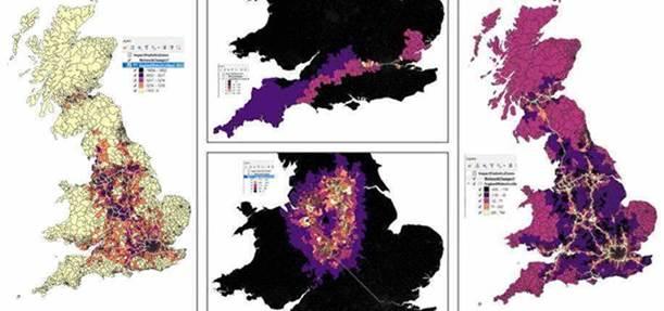
Prof. Michael Batty will share how QUANT (Quantitative Urban ANalyTics) models land transport networks for an entire nation, at the scale usually used to analyse individual cities. This model predicts the trends on commuting, employment and residential patterns in cities across the United Kingdom, and paints a picture of what could possibly be the new normal for UK cities.
18 June 2020, Thursday
4.00pm - 4.40pm Singapore Time (GMT+8)
Speaker:

Prof. Michael Batty CBE
Chairman
Centre for Advanced Spatial Analysis
Guest Moderator:

HWANG YU-NING
Singapore
*Simultaneous interpretation will be provided in Mandarin.