
|
Home >
Settings >
Archives >
September 2019 >
Regional Geospatial Youth Forum 2019
Regional Geospatial Youth Forum 2019
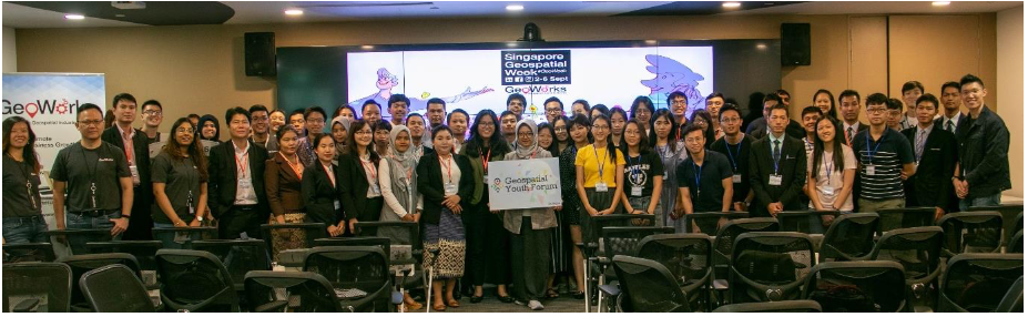
The Singapore Geospatial Week (2nd to 6th September 2019) ended off on a high note with the inaugural Regional Geospatial Youth Forum (RGYF). The forum, held on 6th September 2019, saw close to 60 young geospatial professionals from around the ASEAN region who gathered and shared their experiences through a series of engaging conversations, geospatial posters showcase, interactive Geoworkshops and lightning talks.
Focusing on three key principles: Innovate digital solutions for a dynamic environment, Collaborate to address present and future challenges and Inspire the next generation of Geospatial professionals - the RGYF aims to build a community of passionate Geospatial champions.
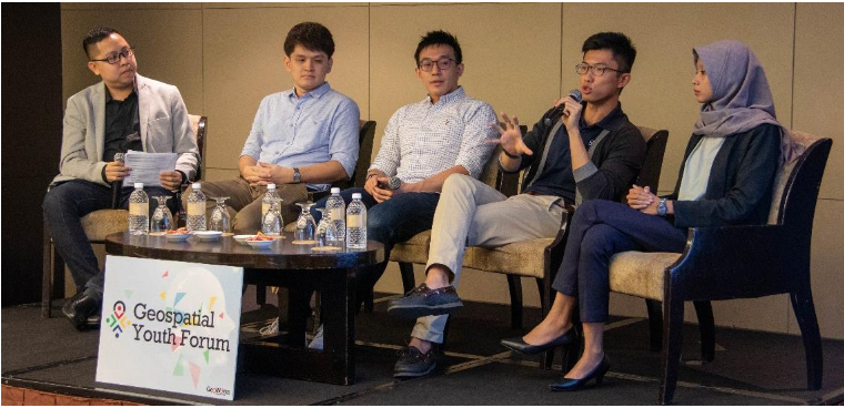
Inspiring Conversations
Participants got the opportunity to engage with four young professional speakers from varying backgrounds (academia, private and public sector) and nationalities (Indonesia, Malaysia and Singapore) through a dialogue session. The speakers shared their personal geospatial stories and their motivation to contribute to the geospatial profession. The dialogue also highlighted on how one who has a non-geospatial background could contribute to the geospatial community. For example, a person with marketing background can promote geospatial solutions. There is definitely something spatial for everyone!
|
| Speakers shared their personal geospatial experiences |
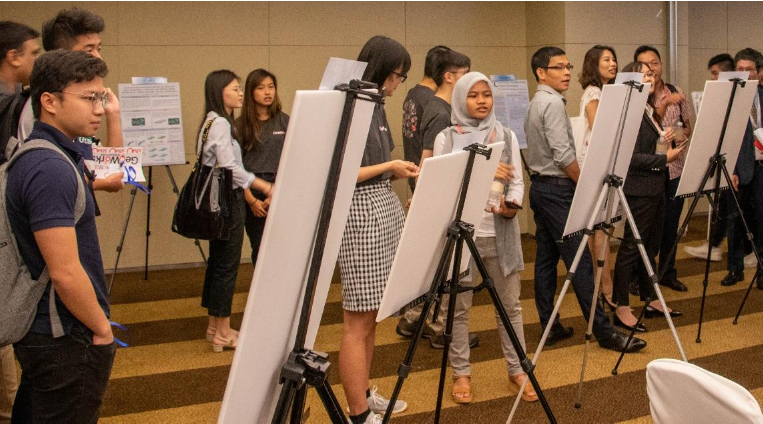
Showcase of Geospatial Posters
The forum also featured about 20 geospatial posters from Brunei, Indonesia, Laos, Myanmar, and Singapore. The showcase provided opportunities for the young professionals from the region to connect and build new relationships. RGYF participants also shared their use of geospatial information and technology in their home countries.
“The poster exhibitions exposed me to interesting applications of [Geospatial] in neighbouring countries, which included areas that are not usually explored in Singapore, such as channel morphology”, said one of the local participants. The showcase was lively, bustling with energy and filled with laughter!
Interactive Geoworkshops
Participants took part in interactive geospatial workshops such as “Creating and Validating Crowdsourced Data” by Grab; “Create Your Own Maps” by MapTime SG; “OneMap Community Workshop” by OneMap and Mogul.SG. A participant from Vietnam shared about the things he learned at the workshops are “new and wonderful” to him, as such he is now able to create maps using Mapbox. Indeed, an afternoon filled with knowledge sharing!
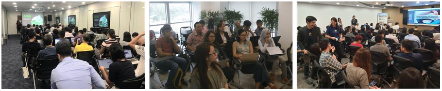
Young professionals participated in various interactive GeoWorkhops
Lightning Talks and Augmented Reality Trail
Participants also got to hear from various geospatial users and industry players on how geospatial can be applied in the real world. For example, Dr Ang, a wildlife research scientist, uses geospatial to understanding the spatial use of forest habitat and identify key conservation hotspots to ensure the long-term survival of the highly threated species, Banded Langurs (primate).
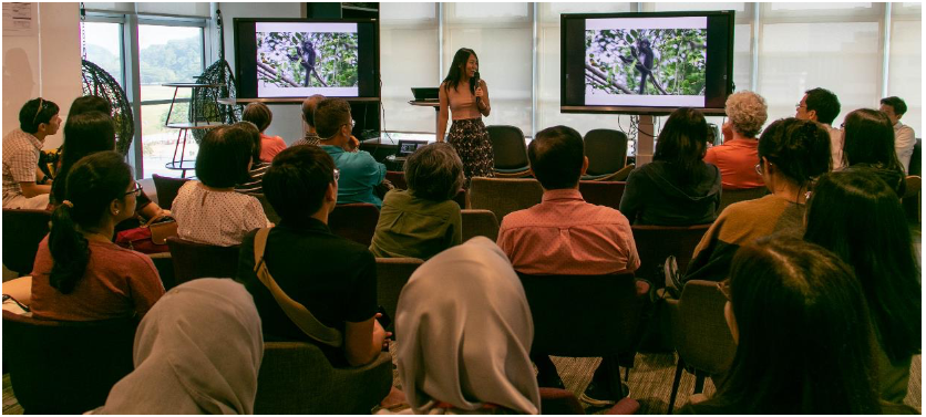
Sharing on the Geospatial application for wildlife research
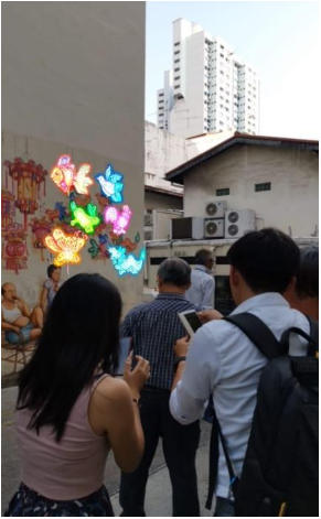
Finally, participants experienced how cross-domain technologies such as Augmented Reality can synergise with geospatial technology. For example, LDR Technology, one of GeoWorks’ GeoTech, incorporated augmented reality with their locational-based application to allow users to appreciate and experience heritage and culture through Yip Yew Chong’s Mural Street-Arts. Wow! What an immersive experience!
The RGYF was a success in bringing together young geospatial professionals from the region with a common passion to apply, develop and proliferate Geospatial information and technology. Indeed, the forum is just the first step towards building an ASEAN Geospatial community. We hope to see more of such efforts to come!