
|
Home >
Settings >
Archives >
November 2021 >
SgGeoFest 2021: RGYF GeoInnovation Panel
SgGeoFest 2021: RGYF GeoInnovation Panel
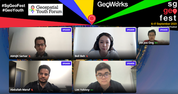
(Clockwise from right): Bell Beh, Yohhny Lim, Abdullah Maruf and Abhijit Sarkar.
Entrepreneurs from the Geo-tech start up scene and Geospatial professionals gathered at the Regional Geospatial Youth Forum during the Singapore Geospatial Festival 2021 #SgGeoFest to share how innovative geospatial solutions are used by tech start-ups and government agencies to tackle different types of challenges today.
Jiin Joo, CTO & Co-founder of Garuda Robotics moderated the panel session and asked panellists to share more about their geospatial journey and how their companies have been using geospatial technology.
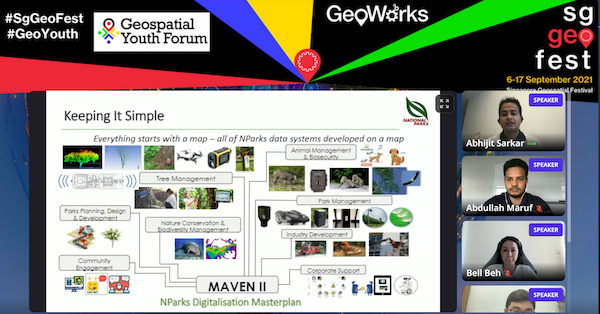
Abhijit Sarkar from Singapore’s National Parks Board described his role in a project called Maven 2 to streamline processes in parks and wildlife management with geospatial technology such as creating digital inventories of trees and applying video analytics for crowd management in parks.
Bell Beh from Buzz AR shared how she left a lucrative legal career to build a Augmented Reality (AR) company so that she can help “add” more happiness to people by connecting people to each other and to places virtually with AR technology.
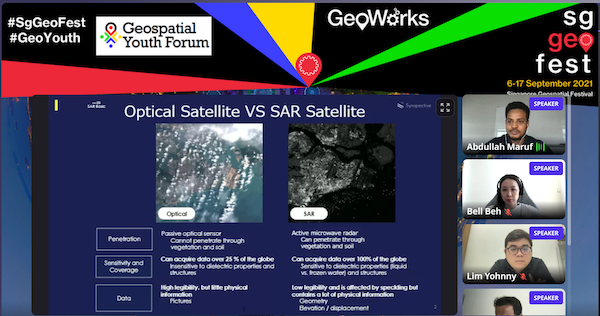
Lastly, Abdullah Maruf from Synspective Inc. shared how his company is helping to save lives by providing more timely data for natural disaster detection and monitoring from Synthetic Aperture Radar (SAR) satellites. SAR satellites are able detect land displacement up to millimetre accuracy at all weather conditions and are invaluable in detecting nature hazards such as landslides and for monitoring flood damages. By being able to launch such satellites cheaply, Synspective has helped to make such data much more reachable.
Wrapping up the panel, Bell offered to following advice to young geospatial professionals and students who were interested Bell to start their own entrepreneurship journey:
“Know what you want in life and believe in it, and be super uncomfortable, work harder than others, plan for the worst and the rest will fall into place.”
View recording here.