|
Home >
Settings >
Archives >
March 2022 >
Women in Geospatial Series: Stephanie Khoo
Women in Geospatial Series: Stephanie Khoo
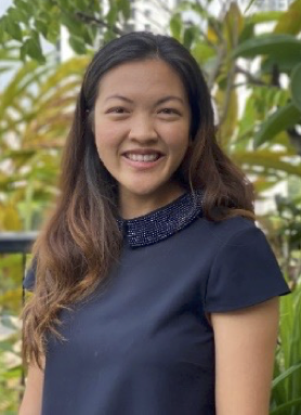
In our first-ever Women in Geospatial Series, we spoke to Stephanie Khoo, a Senior Geospatial Specialist at the Singapore Land Authority.

Stephanie Khoo works as a Senior Geospatial Specialist at the Singapore Land Authority.

What is your current role?
I am a Senior Geospatial Specialist at SLA under the Geospatial and Data Division. I work under the Geospatial Spatial Systems and Technology Department.
My team is currently working on a project that focuses on using machine learning to improve the efficiency of geospatial data collection. I work on training the machine learning models as well as developing a web application to enable users to collect geospatial data, sped up through the use of these AI models. I also undertake research and exploration of geospatial technologies for various domains; This includes Digital Twins, wayfinding, 3D modelling, and geospatial data analytics.
How long have you been in the geospatial sector?
I have been in the geospatial sector for six years, since the time I graduated.
Why and how did you get into the geospatial sector?
In university, I took a module on GIS and remote sensing and was excited by the possibilities of uncovering so much about the world just by analysing geospatial data. After graduating, I worked for Mott MacDonald, an engineering consulting firm. While I was there, I used GIS regularly to undertake analyses for various engineering projects, from feasibility studies for hydropower plants, to flood risk analysis. I saw the value of geospatial and how it could help us simulate various scenarios so that we could make better decisions that would therefore lead to better outcomes.
Did you face any challenges entering the geospatial field? If so, can you please provide a brief summary?
I think that the geospatial field is generally very welcoming. You do not need to specifically study geospatial in school to be able to enter the field. You just need to be willing to put in the time and effort to learn.
That being said, I think the main challenge for me is that geospatial is a very broad field that is constantly evolving. The use cases also cover many different domains. Therefore, one of the challenges is having to constantly learn, from keeping up with the latest technologies to learning about the different domains we apply geospatial to. The geospatial field certainly keeps you on your toes. This means there is never a dull moment!
What kind of projects do you generally work on? Talk to us about a specific project that you are currently working on or are proud of? What type of problems do you solve in your work?
The main project I am working on right now is an app for hyperlocal data collection. We are using AI and machine learning to speed up the collection of such hyperlocal data. The app works by ingesting a picture taken by the user of a feature we are interested in mapping. The machine learning algorithms running on the backend of the app then helps us automatically classify the feature and extract semantic information available from the scene text. Hence, helping to automate and increase efficiency in geospatial data collection. It is one interesting way of applying machine learning and AI technologies to geospatial.
What excites you about geospatial innovation?
I believe that geospatial technologies have the ability to give us a holistic view of the various factors impacting the complex problems we face today. These pressing issues are affected by a plethora of factors across social, economic and environmental domains. Geospatial technologies can act as the glue to combine data from all these domains together. We can thus use Geospatial to model, simulate and analyse these issues and come up with better decisions to address them.
What skills are needed to work in the geospatial industry and what advice would you give to women who wish to enter the geospatial industry?
Being open to new ideas and being willing to learn is important. The geospatial industry is very welcoming and open to people from various domains. In fact, we encourage it because it brings in new and interesting perspectives. In terms of technical skills, learning how to use geospatial software like QGIS or ArcGIS is a good place to start. It would also be good to pick up some coding skills, I would advise to start with Python as it is very versatile for analysis, visualisation and even creating web maps that you can share with your friends.
I hope that more women join the geospatial field and be the voice we need to speak up about issues important to us. Women bring in important perspectives that men might miss. Women, who are often the primary caretakers in their families, are more inclined to map facilities related to family care, such as health services, childcare facilities and even where to get food for the families1. In a world where decisions are increasingly driven by data, we need to ensure that women and the issues important to us, are well represented in this data. Research has shown that when women decide what gets mapped, we see a safer world2. Therefore, my advice, and also a reminder to myself, is: Don’t be afraid to speak up, your voice and opinion matters in creating a better world for us all.
Stephanie's Educational Qualifications
- Geophysics, BSc, Imperial College London
- Applied Geographic Information Systems, MSc, National University of Singapore