
|
Home >
Settings >
Archives >
June 2021 >
Research on Social Segregation
Research on Social Segregation
CITYDATA, a GeoWorks GeoMember, reported on a research on social segregation by the Asia Competitiveness Institute on the website, UniverCity.ai.
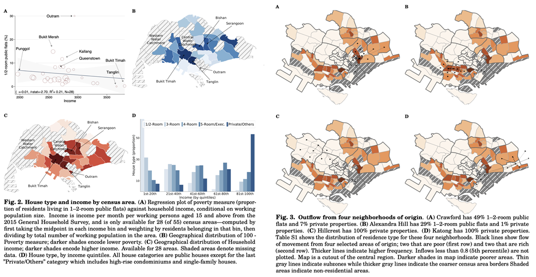
In the study, “Segregation Across Neighborhoods in a Small City”, researchers used GPS (global positioning system) ping records from CITYDATA.ai and tested whether real-time movement across neighbourhoods in Singapore, which are geographically refined, is correlated with census-derived poverty levels. The findings supported the use of GPS-type data as an emerging tool to understand and study social interactions at a temporal frequency much higher than possible with traditional census-based measures.
The anonymized mobility data and trip hop movement patterns for the research were contributed by CITYDATA.ai as part of the UniverCity Council initiative.
For more information: