
|
Home >
Settings >
Archives >
January 2022 >
Ridenjoy App Helps Cyclists Plan Routes on Paths and Park Connectors
Ridenjoy App Helps Cyclists Plan Routes on Paths and Park Connectors
 |
 |
|---|---|
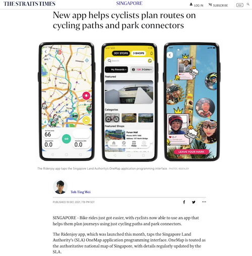
Cyclists will now be able to use the newly launched Ridenjoy app to help them plan journeys on cycling paths and park connectors in Singapore. The Ridenjoy app taps into the programming interface of SLA’s OneMap application, the authoritative national map of Singapore.
Ridenjoy's co-founder Kelvin Phang said that the app typically suggests routes that are longer than those proposed on Google Maps.
“If you want to commute, you should use Google Maps,” he said. But as many people, especially those with children, prefer not to cycle on roads, Ridenjoy might be a better option, he added.
Mr Phang noted that Ridenjoy also differentiates itself by showing other useful information, such as bicycle parking, bicycle repair kiosks and water coolers. He said that he came up with the app idea when he was trying to figure out how to cycle from his home to his office without using traffic-heavy roads, and successfully applied for a grant under Sport Singapore's Blended initiative to pursue the project.
Read more: