
|
Home >
Settings >
Archives >
December 2021 >
SgGeoFest 2021: Utilising 3D Data in a 3D Singapore Sandbox Environment
SgGeoFest 2021: Utilising 3D Data in a 3D Singapore Sandbox Environment
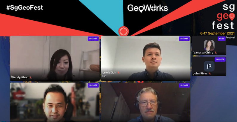
Clockwise from left: Wendy Khoo (GeoWorks), Lewis Goh (Esri Singapore), Dr Uwe Jasnoch (Hexagon) and Noah Arles (Autodesk).
"First of all, we definitely appreciate the amount of data and the quality of data that SLA has shared with us that can be seen in the demo of how we can visualise that and to create the realistic perspective of things. Kudos to SLA to really build up that kind of quality of data," said Lewis Goh, Chief Solution Architect at Esri Singapore.
Lewis Goh from Esri Singapore discussed how 3D geospatial data can enable data visualisation for effective planning.
Mr Goh was speaking at a panel, moderated by Wendy Khoo from GeoWorks, with fellow 3D Singapore Sandbox partners – Autodesk and Hexagon – during the Singapore Geospatial Festival 2021 #SgGeoFest in September.
The 3D Singapore Sandbox is a programme launched in 2020 to encourage the use of 3D geospatial data to develop and test new applications and services. It contains 3D geospatial data such as 3D building models from the Singapore Land Authority (SLA) and the private sector.
The speakers discussed 3D data use cases for the AEC sector on 3D visualisation, shadow impact analysis and visibility study for buildings.
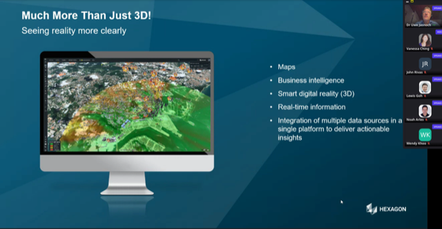
Dr Uwe Jasnoch from Hexagon gave a presentation on using the 3D Singapore Sandbox as a digital twin.
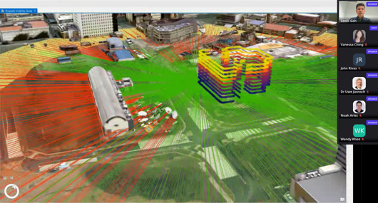
Mr Goh gave a demonstration of how 3D geospatial data can enable data visualisation for effective analytical and planning including building shadow analysis and dengue hotspots.
“Our platform runs on open standards to integrate and bring in a wide variety of data sources to enrich your digital twin. Data such as base maps, digital terrain, building beam, infrastructure models and business data can be harmonised on a single platform in 3D. Here we have a 3D map to visualise dengue outbreaks. This allows us to understand the importance of locations to spot trends and activities of dengue patterns,” he said.
Dr Uwe Jasnoch, VP of Business Development and Director of Presales APAC at Hexagon, gave a presentation on using the 3D Singapore Sandbox as a digital twin. “A digital twin is more than a pure 3D model because it also helps as a common platform for all the different stakeholders of the city to bring in the data, to fuse the data, to break up the silos, the data silos and do this in an appropriate special manner with 3D visualisation,” he said.
Noah Arles, Technical Specialist Manager at Autodesk, presented how 3D geospatial data can be used to enable effective analytical and optimisation planning through a single platform.
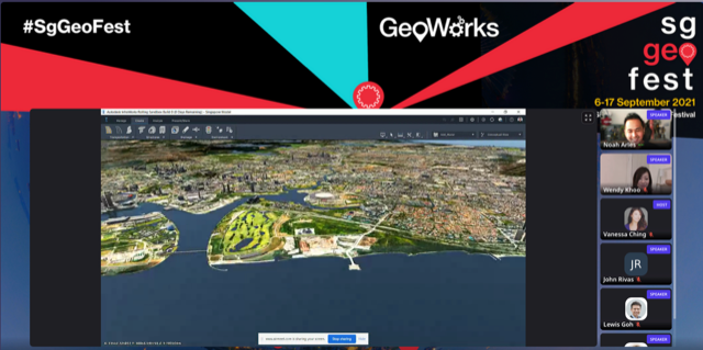
Noah Arles from Autodesk presented how 3D geospatial data can be used to enable effective analytical and optimisation planning through a single platform.
“Now is the time where we've democratised technology so that we can allow even the most ordinary users to capture data from the web and combine that with a myriad of different types of data to make the planning and the preliminary design more interactive,” he said.
He said that by being able to fly a drone, users are able to “stitch together a point cloud of an existing structure”. This, he added, is one of the fastest ways to gain a better understanding of what an existing project could look like. “You can see that by simply capturing drop photos from drones you can stitch those together to gain a better understanding on how it would impact this site,” he said.
Mr Arles added that it is now easy to work with 3D. “You don't have to be an expert in any tech. As long as you have experience with the mouse and with data, you'll get visual feedback accelerating the decision-making process,” he said.
View recording: https://youtu.be/MbktxBvVo24