
|
Home >
Settings >
Archives >
December 2021 >
SgGeoFest 2021: RGYF GeoEducation I
SgGeoFest 2021: RGYF GeoEducation I
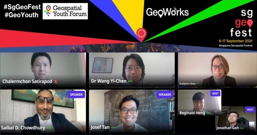
With the increasing prevalence of geospatial related work, access to education pathways of future young geospatial enthusiasts are crucial in ensuring that they are equipped with necessary in-demand geospatial skillsets prior to their entry into the workforce. During the GeoEducation One panel at the Regional Geospatial Youth Forum held at the Singapore Geospatial Festival, panelists delved into a discussion on the curriculum of geospatial education in various Institutes of Higher Learning and the industry demands for graduates in geospatial-related majors. The panelists went further to explore the discourses on the methodology employed by universities to educate students in this rapidly-changing landscape and the need for upskilling young geospatial enthusiasts.
Thought-provoking insights and sharing from the plenary session were made possible with the diverse panel featuring:
- Dr Chalermchon Satirapod, Professor and Head, Department of Survey Engineering, Faculty of Engineering from the Chulalongkorn University
- Dr Wang Yi-Chen, Associate Professor from the National University of Singapore
- Dr Suelynn Choy, Professor of Geospatial Science and Satellite Navigation and Director of RMIT Satellite Positioning for Atmosphere, Climate and Environment (SPACE) Research Centre from the Royal Melbourne Institute of Technology (RMIT) University
- Mr Saibal D. Chowdhury, CEO and Co-Founder of Urbanetic Pte Ltd
The session was moderated by Josef Tan, Lead Specialist Geography, Curriculum Planning and Development Division from the Ministry of Education.
Currently, various geospatial-related degrees are offered across the panelists’ home universities. In particular, most geospatial-related courses were housed under the geography department due to the strong relevance of geospatial to the geography domain. Dr Wang shared the quantitative revolution in geography and study of the “place, space and people” resulted in the prevalence of GIS modules situating in the geography department. However, it is also common to see that other departments such as the engineering and built environment would also offer GIS-related modules as it is intertwined to those area of studies.
Dr Chalermchon shared that existing course curriculum is usually revised on a five-year cycle and potentially, with the rapid movement in industry trends, it may necessitate universities to investigate more frequent revisions to the geospatial modules offered.
Mr Chowdhury expressed that the current steady stream of talents into the geospatial industry is an “encouraging” trend. He said that companies are interested in graduates who can apply the knowledge picked up during their university course to the real-world context. “The main issue is not in getting people a degree… it is in taking classical GIS education into the digital world and then solving real life problems. The ability to interpret geospatial data into something useful is more important than ever,” he said.
Dr Chalermchon added that students should have a broader perspective and avoid seeing GIS as just a tool. To ensure that geospatial professionals stay abreast with the developments in this industry, one should seek continuous growth and develop a lifelong learning approach. The ability to tailor one’s expertise in utilising geospatial software to assist with clients’ needs is of great importance. Particularly, the panelists expressed their agreement that the fieldwork element in the university’s geospatial curriculum will be very applicable for students to put into practice the knowledge gained during their geospatial courses.
The panelists echoed the importance of creativity and imagination to succeed in the geospatial industry as these skillsets will serve geospatial graduates in good stead to solve real-world problems that they will encounter at work. Nonetheless, a solid foundation in geospatial knowledge and skillsets would be necessary for graduates before striving to inculcate creativity and imagination.
“The main issue is not in getting people a degree… it is in taking classical GIS education into the digital world and then solving real life problems. The ability to interpret geospatial data into something useful is more important than ever”
Mr Saibal D. Chowdhury, CEO and Co-Founder of Urbanetic Pte Ltd
|
Further to the university curriculum, the panelists discussed the importance of interdisciplinary skills as a geospatial professional would tend to require cross-industry knowledge and expertise to execute their work effectively. Beyond an education focusing mainly on geospatial and GIS technologies, universities’ geospatial programmes should aim to cover a diverse range of topics to allow a more comprehensive appreciation of the geospatial landscape. Topics such as environmental science, ecology and human geography are highly applicable to geospatial, according to Dr Choy.
To round up the sharing, the panelists express that the rapid growth in the geospatial industry presents a limitless future for the geospatial-trained graduates as they have seen many of their students taking their step into a geospatial career in both the public and private sectors. The panelists shared on the 3Cs “curiosity, creativity and coding”, to inspire the young geospatial enthusiasts in the audience to begin their adventure on this exciting industry.
View recording here.
This report was written by Reginald Heng (Senior GeoSpatial Consultant, Geospatial Data & Planning, Singapore Land Authority) and Nabil Azfar Shafique (GSDD Intern, MOE Geography Talent Development Programme).