

Look for a
lock () or https:// as an added precaution. Share sensitive
information only on official, secure websites.
SLA announces OneMap GPT challenge and new education collaborations at 5th Singapore Geospatial Festival to deepen geospatial capabilities in Singapore - Annexes
ANNEX A
Welcome Remarks by Mr Colin Low, Chief Executive of SLA, at the Joint Opening of the Singapore Geospatial Festival 2023 & the Open Geospatial Consortium Member Meeting at Lifelong Learning Institute on 26 September 2023 (Tuesday)
Opening
Dr. Mohamad Maliki Bin Osman, Minister, Prime Minister's Office, Second Minister for Education and Second Minister for Foreign Affairs,
Professor Aaron Thean, Deputy President (Academic Affairs) and Provost, National University of Singapore,
Mr. Scott Simmons, Chief Standards Officer, Open Geospatial Consortium,
Distinguished guests,
Ladies and Gentlemen,
Good morning.
1. A very warm welcome to all of you to the joint opening of the Singapore Geospatial Festival 2023 and the 127th Open Geospatial Consortium Member Meeting.
2. I am proud to say that this year marks the fifth year SLA is organising GeoFest. Every year, we host GeoFest as part of our efforts to raise awareness of all things geospatial-related. I hope that I will continue to see everyone gather at GeoFest for many more years to come.
Enriching Minds, Empowering Lives
3. This year, the theme of GeoFest is “enriching minds, empowering lives”. There are two parts to this theme.
4. First, ‘enriching minds’. Over the past ten years, I am sure that all of us have observed a clear surge in the usage of geospatial data, information, and technology. To meet this growing demand, it is therefore crucial to build a talent pipeline to nurture national geospatial capabilities. There is a saying that ‘learning never ends’, which I fully agree with. Geospatial-related content must be included across the full spectrum of the education journey, from our youth to working professionals. Here at SLA, we have been actively working towards this goal.
5. Let me begin with our geospatial initiatives aimed at primary school children. Since 1982, the Science Centre Board has encouraged primary school students to engage in science, technology, engineering, and mathematics (‘STEM’) learning beyond the classroom by awarding kids with badges after they complete a set of relevant missions. The badges cover traditional subjects like biology, chemistry, physics – and now, geospatial. SLA first introduced the Young Geospatial Scientist badge in collaboration with the Science Centre back in March 2021. Since then, the programme has introduced thousands of primary school students to the exciting world of geospatial. Through tasks such as learning to read maps or locating nearby Points of Interest, our primary school children are exposed to the topic of geospatial from as young as 9 years old.
6. For secondary school students, SLA supported the Science Centre in this year’s Singapore Science and Engineering Fair (‘SSEF’), in partnership with MOE and A*STAR. During the SSEF Public Visit Day, students who visited SLA’s station were able to explore a replica of Science Centre and Marina Bay Singapore through the virtual world of Minecraft. Through such interactions, we aim to spark students’ interest in geospatial and prompt them to consider the potential applications of reality mapping for urban planning and sustainability.
7. Next, for junior college students, SLA will be launching a new Map Our World programme in November this year in collaboration with MOE, geospatial technology providers, and surveyors. Map Our World is a holiday camp that will give junior college students a taste of life as a geospatial and geomatics professional. During the camp, they will have the opportunity to learn from GIS software vendors, surveying instrument vendors and local practitioners.
8. For tertiary students, SLA will soon be launching the ASEAN Geospatial Challenge 2024. The AGC is an annual competition that challenges tertiary students to come up with geospatial solutions to meet real life needs. Time after time, I have been amazed by the creativity of students from the region – not just from Singapore, but across Southeast Asia. Last year, we awarded top prizes to six winners from Indonesia, Singapore, and the Philippines. The winning solutions ranged from volunteer management systems to build cohesive and sustainable communities, to mobile apps that improve crop production and irrigation development. From the sheer quality and variety of submissions we receive from students every year, I can confidently say that the future of geospatial in ASEAN is bright. Of course, we work hand in hand with our close counterparts from the region to make the AGC a success every year. Some of them are here with us today for their annual ASEAN Geospatial Agencies’ meeting, held in conjunction with GeoFest. To all our ASEAN friends in the room – welcome to Singapore, and I hope you have a fruitful meeting this afternoon.
9. Last but not least, we have our adult learners. As a nation who embraces life-long learning, geospatial education is equally important for working professionals like you and me. Over our many engagements and conversations with geospatial professionals in the past few years, we realised that there is strong industry demand for adult geospatial education. Today, I am happy to announce that SLA will sign an MOU with NUS to develop geospatial professional certifications and courses for working adults. These courses are tailored to professionals who are keen to acquire geospatial skills, but who may not be able to afford the time or commitment that a full-time degree demands. The first intake for the graduate certificate in Applied GIS commenced their studies last month, and we hope to continue expanding the course offerings in future. As I mentioned earlier, learning never ends. Whether you are 9 or 39 years old, we want to equip you with the skills necessary to succeed in your geospatial career.
10. The second part of our theme is ‘empowering lives’. Apart from building up our national geospatial capabilities, geospatial is an integral tool that can be used to improve and enhance our daily lives. Take education, for instance. How many of us here learnt history through rote memorisation? Do you still remember what you learnt? During my school days, classes like history could sometimes be boring and ineffective since we had to memorise numerous facts via written text. Recently, our junior college and university students have found new ways of using geospatial to make learning more exciting and immersive. Using SLA’s geospatial expertise and resources from the National Heritage Board, students created immersive trails that visualise historical monuments and heritage trails in both 2D and 3D. If you have the time, I highly encourage you to experience these trails firsthand at the NHB exhibit. Rather than just reading sterile textbooks, students can see and experience points of historical, social, or cultural value for themselves. Such immersive learning has much potential – not only for history, but also for subjects like geography, social studies, and so on. Education can be brought to life by using geospatial as the key to unlock this potential.
11. On top of this, SLA has partnered MOE closely to enhance MOE-EduGIS, aimed at secondary school students. MOE-EduGIS is an educational platform that utilises geospatial government data and ESRI products to produce and deliver digital maps. School teachers can use these maps, which are easily accessible via the national e-learning platform, for educational purposes. I would like to take this opportunity to thank ESRI for their invaluable help throughout the development of MOE-EduGIS. We are constantly improving and upgrading the platform to elevate students’ learning experiences. During their showcase later, we will hear from students from Ahmad Ibrahim Secondary School on how the platform has helped them in the classroom. These are just a few of the numerous ways that education can be made more interactive and engaging through geospatial.
12. Of course, geospatial’s impact and potential are not limited to education alone. Geospatial has demonstrated its immense value in our everyday lives, whether it may be routing paths to the nearest neighbourhood amenities or locating nearby ART kits during the pandemic.
13. To provide greater convenience and more useful map-based information at your fingertips, I am pleased to announce that SLA will be launching the OneMap GPT Challenge next month. This challenge will combine the latest trending topic, AI, with geospatial technology. Imagine this – you are planning the itinerary for your next Sunday outing with your family. You might have grandparents who are not as mobile, and young kids who love being active. How do you consider everything, everywhere, all at once? Wouldn’t it be great if with a single click of a button, the ideal route for your Sunday family day out could be generated on OneMap based on your preferences? This could become reality soon through the OneMap GPT challenge, where participants will be invited to come up with innovative solutions to such problems. This challenge represents just the start of our AI journey. SLA will continue to ride on the latest trends in technology to continue improving and empowering lives through geospatial.
OGC Member Meeting
14. In tandem with GeoFest, we are pleased to once again be hosting the 127th Open Geospatial Consortium (‘OGC’) Member Meeting here in Singapore.
15. The OGC is dedicated to advancing the future of geospatial through open standards and technologies. It is always an honour to host such an experienced and accomplished community of experts with us in Singapore. I hope everyone will make the most of this opportunity to interact and learn from one another.
Closing
16. The lineup for the week ahead is absolutely packed with talks, workshops, and expert panels. You will be able to hear from not just geospatial experts, but also from students starting out on their geospatial journeys. No matter which stage of your geospatial journey you are at, there is something for everyone at GeoFest 2023.
17. I hope these activities will be enriching and empowering for all GeoFest attendees, and I wish everyone an enjoyable time in the days ahead. Thank you.
ANNEX B
About OneMap
OneMap is the authoritative national map of Singapore with the most detailed and timely updated information developed by the Singapore Land Authority (SLA). OneMap can be used to obtain street-level geospatial information, or narrowed to specific query such as land ownership, the nearest schools and demographic data at/around a location. Developed by an in-house team of developers in SLA, OneMap has been serving the public since 2010, supporting more than 100 public and private sector apps and services with a set of Application Programming Interface (API), such as base maps, address search, routing and reverse geocoding. Some of these apps and services include the Ministry of National Development’s OneService app and the Singapore Civil Defence Force’s MyResponder app. A variety of services such as eldercare services and parking can also be located via the localised data on OneMap.
The OneMap mobile app is available for free download on Apple and Android app store. For more information, please visit www.sla.gov.sg/geospatial-development-and-services/onemap
ANNEX C
Memorandum of Understanding between Singapore Land Authority (SLA) and National University of Singapore (Department of Geography, College of Humanities and Sciences and the School of Continuing and Lifelong Education) – Quotes from signatories
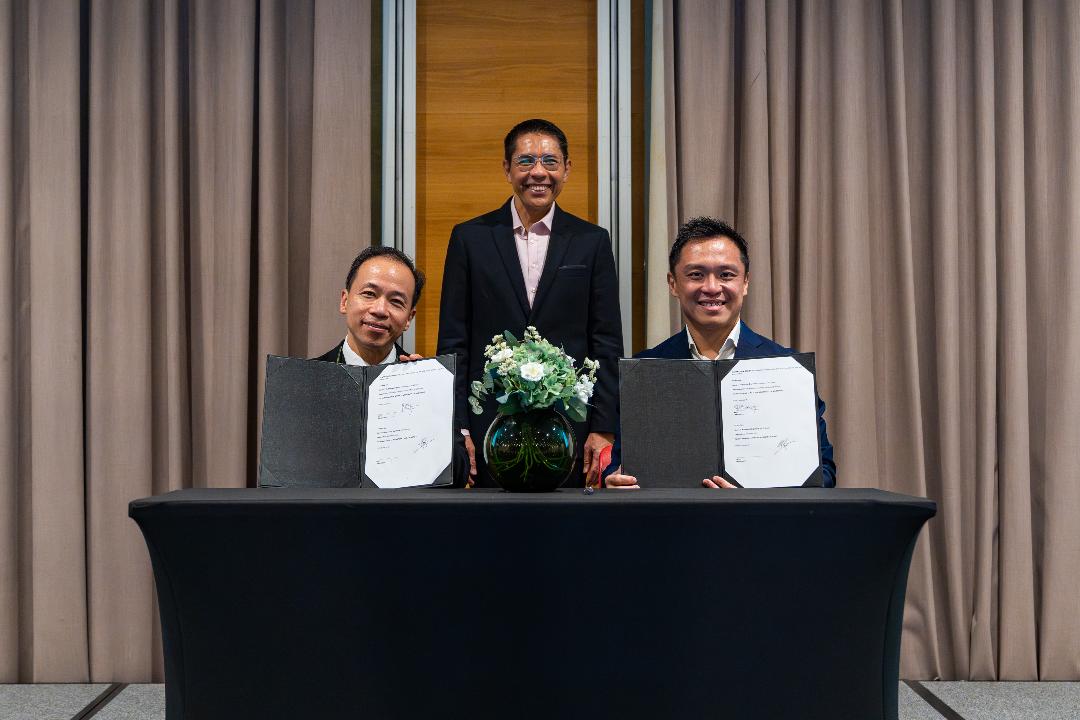
Photo caption: Chief Executive of Singapore Land Authority, Mr Colin Low (right) and NUS Deputy President (Academic Affairs) and Provost, Prof Aaron Thean (left) signed a new Memorandum of Understanding (MOU) on 26 September, to curate a holistic Geospatial graduate programme and professional courses. The MOU signing was witnessed by Dr Mohamad Maliki Bin Osman (centre), Minister, Prime Minister's Office, Second Minister for Education and Second Minister for Foreign Affairs.
“Geospatial technologies form the foundation of Singapore’s smart nation initiative and play an increasingly vital role in solving real world challenges. For Singapore to become a global digital city, it is necessary for us to build up capabilities in geospatial technologies. I look forward to more of such partnerships with industry to nurture a strong pool of geospatial talents to support Singapore’s digital and economic transformation.”
- Dr Mohamad Maliki Bin Osman (centre), Minister, Prime Minister's Office, Second Minister for Education and Second Minister for Foreign Affairs.
“As the national geospatial agency, SLA aims to strengthen our geospatial capabilities and mainstream geospatial for diverse commercial and community uses. In this regard, SLA is delighted to launch Singapore’s first OneMap GPT challenge, in partnership with GovTech and IMDA, to broaden our networks of organisations and professionals from the private sectors and develop more versatile and innovative uses for OneMap.
SLA is also pleased to partner with two key education partners, NUS and MOE, to jointly develop a holistic and strategic approach to drive and uplift Singapore’s geospatial capabilities in the long term, while deepening geospatial interest amongst post-secondary students and advancing new pathways for mid-career switches in the immediate term.”
- Mr Colin Low, Chief Executive of SLA
“NUS is honoured to work with SLA to chart out geospatial educational pathways in support of the government’s push to promote geo-education and build talent pipeline. The introduction of a holistic geospatial graduate programme and other professional courses provides adult learners an opportunity to learn about cutting-edge geospatial technologies and equip them with the skills needed to fulfil their aspirations of having a geospatial career.
- NUS Deputy President (Academic Affairs) and Provost, Professor Aaron Thean
“IMDA is delighted to support the launch of the OneMap GPT Challenge commissioned by Singapore Land Authority to enhance the functions and appeal of the existing OneMap app. With AI revolutionising the way we work, learn and communicate, we see growing opportunities for it to play a pivotal role in transforming digital services, such as in geospatial mapping. We look forward to IMDA’s Open Innovation Platform enabling the development of AI-fuelled innovative solutions, to provide a more personalised and interactive experience for all users.”
- Mr Justin Ang, Assistant Chief Executive of Singapore’s IMDA
ANNEX D
About “Map Our World” Programme
In its inaugural year, the “Map Our World” programme would involve Year 1 Pre-University students from MOE’s Geography Talent Development Programme. The programme will teach students about the fundamentals and importance of mapping, geodata collection and map construction. Students will learn from GIS software vendors, surveying instrument vendors and local practitioners, and get a better idea of the career paths in this industry.
ANNEX E
OneMap in MOE-EduGIS
35 thematic layers from OneMap have been added to MOE-EduGIS, a geographic information system that is deployed by the Ministry of Education to support Geography learning. MOE-EduGIS is used by Geography teachers to create curriculum-aligned digital map applications for classroom instruction and student fieldwork. With the integration of these OneMap thematic layers, teachers and students can now access selected OneMap content via MOE-EduGIS. The available OneMap content now includes historic sites, tourist attractions, dengue clusters, ABC water sites, parks, and nature reserves. The availability of the new data enriches students’ discovery of people and nature in Singapore, supporting their development of spatial awareness, critical thinking, and problem solving. Moving forward, SLA will explore the possibility of scaling up to integrate more OneMap thematic layers in MOE-EduGIS.
ANNEX F
Initiatives for primary and secondary students
Young Geospatial Scientist Workshop
SLA and Science Centre Board(SCB) jointly organised the Young Geospatial Scientist Badge Activity at Blangah Rise Primary School on 24 August and Zhenghua Primary School on 25 August. The session comprised of seven activities and offered students a hands-on understanding of geospatial concepts and applications.
My OneMap Workshop
SLA hosted 12 students from Bendemeer Secondary School at the first “My OneMap” workshop on 7 August. The SLA team shared about geospatial technology and its uses, key elements of a map, and provided a guided tutorial on the creation of a customised map using felt.com with OneMap. Students developed a themed itinerary for overseas visitors to visit interesting sites in Singapore, using felt.com and OneMap, as part of a challenge.