Copyright © 2017
Singapore Land Authority.
All Rights Reserved.
Singapore Land Authority.
All Rights Reserved.
ANNUAL
REPORT
2016/17
REPORT
2016/17

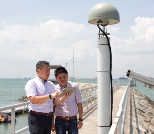
SLA maintains the Singapore Satellite Positioning Reference Network (SiReNT), which provides precise positioning services to Global Navigation Satellite System (GNSS) users in Singapore. SiReNT uses data from multiple satellite systems to provide the high accuracy positioning service in real-time. This high accuracy positioning service is essential for driverless vehicles applications, and is currently used by self-driving shuttle buses at the Gardens by the Bay, as well as autonomous vehicle trials in one-north.
“SiReNT enables real-time centimetre-level precision for satellite-based positioning, navigation and tracking,” says Tan Hua Seng, Jimmy, a key team member involved in the development of SiReNT for usage in the Satellite Assisted Piling initiative, which clinched the MinLaw ExCEL Most Innovative Award. “It is used in construction sites to position foundation piles, for machine guidance across Singapore and for many other precise positioning, navigation and tracking applications. SiReNT is the positioning infrastructure that underpins the development of a smart, resilient and sustainable Singapore.”
SiReNT ENABLES REAL-TIME CENTIMETRE-LEVEL PRECISION FOR SATELLITE-BASED POSITIONING, NAVIGATION AND TRACKING.TAN HUA SENG JIMMY