
Press release
10-year Singapore Geospatial Master Plan outlines key land and maritime initiatives for geospatial enabled outcomes
6 March 2024
Spearheaded by the Singapore Land Authority (SLA) and Maritime and Port Authority of Singapore (MPA), the newly launched Singapore Geospatial Master Plan (2024 – 2033) will enable geospatial-enabled innovations to benefit more segments of society, while addressing the complex challenges Singapore faces as an island-nation. Building on the first masterplan, this second iteration integrates land and marine spatial data development and charts the trajectory of national geospatial development for the next decade across terrestrial and maritime domains, towards the vision of Singapore as “A Leading Global Geospatial Hub”.
2 At the Geo Connect Asia 2024 opening ceremony today, SLA and MPA unveiled several new strategic partnerships and key initiatives to expand the mainstream use of geospatial technology to benefit more citizens, enhance quality of lives and strengthen Singapore’s geospatial capabilities. Please refer to Annex A for the welcome remarks by Mr Yeoh Oon Jin, Chairman of SLA.
3 The new partnerships and initiatives by SLA and MPA were announced by Mr Edwin Tong, Minister for Culture, Community and Youth, and Second Minister for Law, who was the Guest-of-Honour at the event.
Mainstreaming Geospatial
(i) Pioneering Preventive Healthcare for a Healthier Future
4 Mainstreaming geospatial can bring tangible benefits into our everyday lives, particularly in sectors such as social and healthcare. Through close collaborations with key partners in these sectors, geospatial tools and solutions can support national programmes such as HealthierSG and the Enabling Master Plan 2030.
5 Today, Mr Tong witnessed the signing ceremonies for two SLA collaborations - with SingHealth Community Hospitals (SCH) to co-develop a living asset map portal tailored for social prescribing, and with the Ministry of Health Office for Healthcare Transformation (MOHT) to expand the Digital Local Connect (DLC) initiative to benefit more neighbourhoods. Please refer to Annex B for details of both partnerships.
(ii) Barrier-Free Access Routing Function to Promote Inclusivity
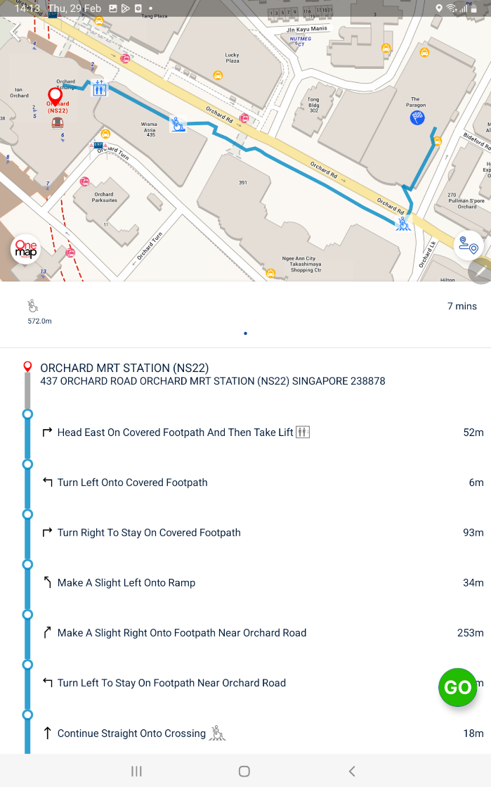
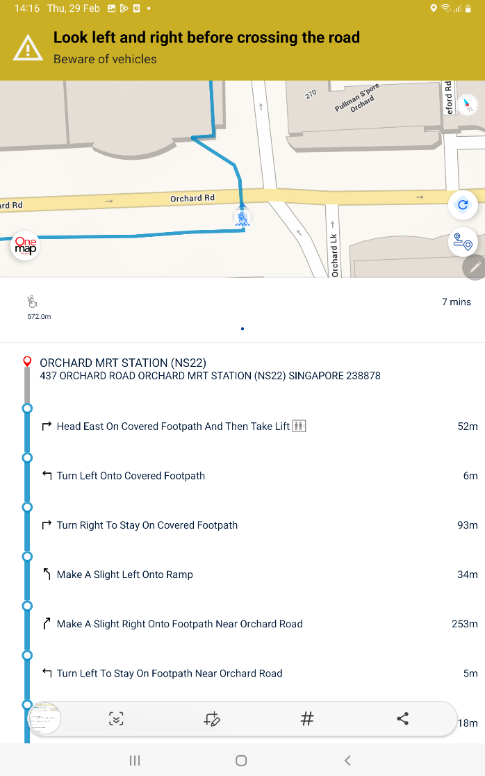
6 Through collaborations with partners like SG Enable, SLA is making strides in mapping pathways towards a more inclusive society. SLA launched the barrier-free access routing function on OneMap today, as an additional mode of wayfinding, in support of the Enabling Master Plan 2030. This routing function will be initially available for selected areas and will be expanded over time. Please refer to Annex C for screenshots of the barrier-free access function on OneMap.
Deepening Singapore’s Geospatial Capabilities
(i) Leveraging Synergies Between Geospatial and Generative AI
7 Beyond extending the benefits of geospatial to a wider community, SLA is committed to deepening our core geospatial capabilities to keep pace with technological advancements and support the increasing demand for high quality geospatial data.
8 Following the successful launch of the SLA OneMap GPT Challenge, supported by IMDA, in October 2023 to explore ways to incorporate AI technologies for innovative solutions on OneMap, two winning teams revealed their prototypes at the opening event today. They were chosen out of 41 entries, from companies, academia and individual participants. The prototypes demonstrate the potential of integrating geospatial and generative AI technologies to develop interactive and smart solutions to offer users greater convenience and personalised map-based services. As one of the first in the world, and the first of its kind in Singapore, the prototypes showcase how the synergistic combination of artificial intelligence, location information and map visualisation can open limitless potential across industries. Please refer to Annex D for details of the prototypes.
(ii) Using Marine Data to support Climate Change Protection and Adaptation Planning
9 GeoSpace-Sea is an initiative by MPA to integrate and provide access to authoritative and consolidated marine and coastal geospatial data. The Centre for Climate Research Singapore, operating under the National Environment Agency (NEA), utilises tidal data from GeoSpace-Sea to analyse rising sea levels in Singapore. This includes an assessment of extreme sea levels as part of the National Sea Level Programme, contributing to the production of accurate sea level projections to support climate change adaptation plans. GeoSpace-Sea data is also used in the development of PUB’s Coastal-Inland Flood Model[1] and analyses on the adequacy of coastal protection measures.
(iii) Driving Geospatial Innovations Across Maritime Domains
10 MPA is building capabilities across various domains to establish comprehensive situational awareness of its operating environment to support operations planning and incident management.
11 In the subsea domain, MPA is collaborating with BeeX, a Singapore-based deep-tech engineering company, to map and provide a comprehensive view of the subsea environment. With the increasing use of underwater drones, the ability to better visualise the subsea environment will enable safe navigation and active management of underwater drone operations, such as seabed infrastructure and underwater inspections.
12 In the sea domain, MPA’s Active Anchorage Management System will utilise artificial intelligence and data from GeoSpace-Sea to allocate and optimise the use of limited anchorage space for vessel anchoring. This is a capability that will be increasingly important to ensure safety as the volume of vessels arriving at the Port of Singapore grows.
Progressing towards A Leading Global Geospatial Hub
13 Singapore is represented in various key platforms at the United Nations (UN) to steer the development and application of geospatial data to help address global climate issues and support nations’ development. Key positions held include the Co-chair of the UN Expert Group on Land Administration & Management, Vice-President for the Regional Committee of UN Global Geospatial Information Management (UN-GGIM), and Co-chair of the UN-GGIM Working Group on Marine Geospatial Information.
14 Mr Colin Low, Chief Executive of SLA said, “As the national geospatial and mapping agency of Singapore, SLA plays an active role in spearheading national geospatial development. This second Singapore Geospatial Master Plan reflects our commitment to integrate and drive geospatial innovation in both the maritime and terrestrial domains. In land-scarce Singapore, we continue to overcome our urban challenges through the innovative use of geospatial technology and data, focusing our efforts on the mainstreaming and deepening of our geospatial capabilities to benefit end users, and enable a smarter, safer, and more sustainable Singapore. SLA is pleased to further our collaboration with MPA to propel Singapore to be a leading global geospatial hub.”
15 Mr Teo Eng Dih, Chief Executive of MPA said, “Having a more comprehensive geospatial awareness across the land and sea domains offers potential to optimise the use of our limited land and sea space, and helps develop new models to support maritime services, such as the bunkering of new marine fuels, as well as long-term coastal planning efforts. MPA looks forward to working with SLA to grow our geospatial capabilities as we upskill maritime professionals and hydrographers to co-develop new products and services with industry.”
16 The Singapore Geospatial Master Plan 2024 – 2033 is a living blueprint that will evolve in response to Singapore’s emerging needs, challenges, and opportunities. It will serve as a launch pad to build the suite of geospatial initiatives, working in collaborations with various users and research partners.
View the Singapore Geospatial Master Plan here: https://go.gov.sg/singapore-geospatial-master-plan-2024
Other highlights at Geo Connect Asia 2024 can be found in Annex E. For a full list of the event highlights, please refer to https://www.geoconnectasia.com/.
[1] PUB’s Coastal-Inland Flood Model, first announced in 2021, is being developed with capabilities to simulate coastal and inland flooding scenarios in Singapore by considering factors such as intense rainfall and rising sea levels.
Issued by:
Singapore Land Authority
Maritime and Port Authority of Singapore
6 March 2024
Annex A
Welcome Remarks by Mr Yeoh Oon Jin, Chairman, Singapore Land Authority at the Opening of Geo Connect Asia at Sands Expo & Convention Centre, Marina Bay Sands, Singapore on 6 March 2024 (Wednesday)
Introduction
1. A very good morning to:
a) Our Guest-of-Honour, Mr Edwin Tong, Minister for Culture, Community and Youth, and Second Minister for Law;
b) Associate Professor Gan Wee Hoe, Chief Executive Officer, SingHealth Community Hospitals;
c) Dr Tan Weng Mooi, Director (Integrated Health Promotion), MOH Office for Healthcare Transformation (MOHT);
d) Distinguished guests, ladies and gentlemen.
2. Welcome to the opening of the Geo Connect Asia 2024. To our international guests, thank you for coming to Singapore to attend the conference. We have an exciting line-up of events over the next 2 days, and I trust you will find the programme relevant and insightful.
Integration of Geospatial in Businesses
3. As many of you are aware, geospatial is driving significant economic growth and innovation globally. According to a report by the Market Research Future, the global geospatial market is projected to exceed 200 billion USD by 2030. Yet, there remains immense untapped potential in leveraging geospatial to support social and economic development across cities and nations.
4. We see a growing trend of geospatial data and technology being integrated with various industries. Businesses are increasingly using geospatial insights for strategic decision-making, including conducting localised market analysis and optimising logistics.
5. As the national geospatial and mapping agency, the Singapore Land Authority collaborates with many industry partners to explore ways to enhance their use of geospatial technology. Last year, SLA signed a MOU with the Container Depot and Logistics Association (Singapore), or CDAS, to improve routing for heavy vehicles using geospatial data such as road conditions and restrictions.
6. I am pleased to announce that we have completed the development of the routing API, which CDAS’ member companies can now easily utilise to route their heavy vehicles more efficiently and safely. We remain committed to expanding our partnerships and mainstreaming geospatial in businesses.
Synergies between Geospatial and Artificial Intelligence
7. Looking ahead, we are currently exploring how to synergize geospatial with the latest technology wave – Generative AI. By combining geospatial with AI, could we uncover previously undiscovered insights, and unlock transformative capabilities?
8. To jumpstart this discovery journey, SLA launched the OneMap GPT challenge with the Infocomm Media Development Authority last year. OneMap, Singapore’s authoritative map, provides detailed and authoritative information to our citizens and businesses. Through this challenge, we are exploring ways to leverage Large Language Models, such as GPT, to enhance OneMap’s usefulness and relevance to the daily lives of Singaporeans.
9. We were very heartened to receive a total of 41 entries for this challenge, and we will be sharing more about the winning entry later today. I am eager to see how we can further leverage generative AI and geospatial to push technological boundaries to better serve Singaporeans.
Nurturing Geospatial Talents
10. To meet the growing demand for geospatial expertise, it is crucial to nurture our pool of geospatial talents, starting from young.
11. In collaboration with the Ministry of Education, geospatial technology providers and surveyors, we initiated our inaugural Map Our World programme in November last year. The programme aims to spark students’ interests in map-making, through a challenge that encourages them to come with up maps to support sustainability causes. It also offers students a taste of life as a working professional via job shadowing with surveying and geospatial firms.
12. We have also organised four editions of the annual ASEAN Geospatial Challenge, where tertiary students develop geospatial solutions to address the United Nations’ Sustainability Development Goals. This year, we have received 49 entries from four ASEAN countries, namely Indonesia, Philippines, Thailand and Singapore.
13. The innovation and creativity displayed by students continue to inspire us. We are delighted to announce the winners of both the Map Our World programme and the ASEAN Geospatial Challenge during the Awards Ceremony tomorrow.
Closing
14. I trust that my remarks have offered you a glimpse into what is achievable and the exciting prospects that lie ahead. I encourage each of you to take full advantage of this conference to cultivate partnerships, explore new possibilities, and seize the opportunities ahead.
15. With that, I wish everyone an enriching conference. Thank you.
Annex B - (i) Memorandum of Understanding between SLA and SingHealth Community Hospitals
Objective
To strengthen the partnership in leveraging geospatial technology for healthcare, a Memorandum of Understanding (MoU) was signed by Mr Colin Low, Chief Executive of SLA and Associate Professor Gan Wee Hoe, Chief Executive Officer, SingHealth Community Hospitals on 6 March 2024 at Geo Connect Asia 2024. Witnessed by Minister for Culture, Community and Youth, and Second Minister for Law, Mr Edwin Tong, the MoU will foster closer collaborations between both organisations in developing spatial analysis capabilities to improve decision-making in healthcare and advance population health.
One such project that SLA and SCH are working on is the co-development of a living asset map portal on community assets (piloting with the Sengkang precinct) to support social prescribing. Social prescribing connects people with a range of non-medical services in the community to improve their health and wellbeing. These assets include community groups that forge social connections, activity-based groups that promote health-social integration, and silver volunteerism groups to engender the purposeful engagement of seniors.
Demarcated Area of Living Asset Map Portal
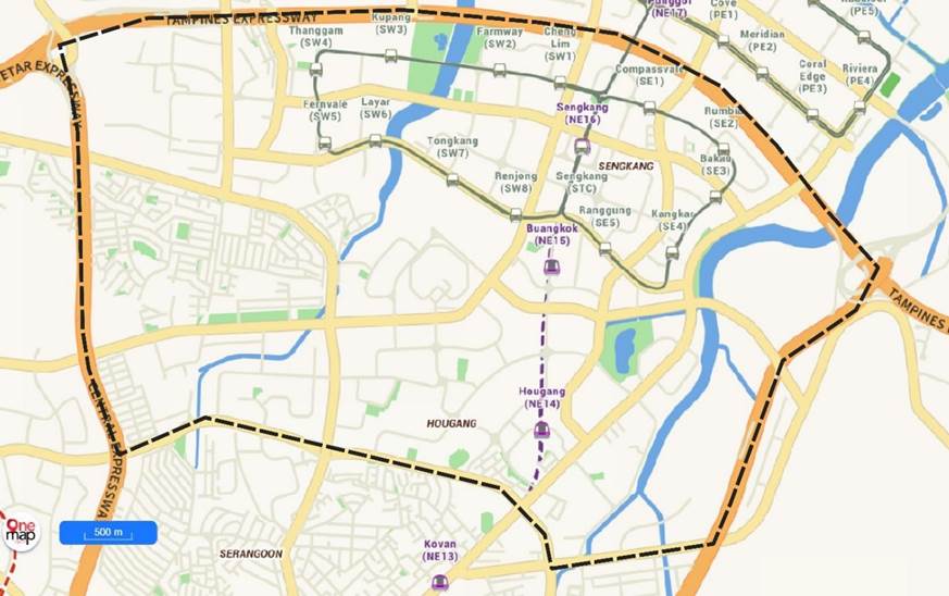
North-East Target Area of the Living Asset Map Portal
Outcome
Mapping the proximity of these activities according to personalised interests allows individuals to conveniently take an active role in managing their own health and wellbeing.
This digital platform aggregates geospatial and community-based data to support referrals that connect patients with health-promoting assets and resources with the aim of empowering individuals to take charge, manage and improve their health and wellbeing.
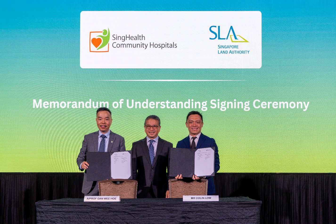
Mr Colin Low, Chief Executive of SLA (right), and Associate Professor Gan Wee Hoe, Chief Executive Officer of SingHealth Community Hospitals (left), signed a Memorandum of Understanding to develop a Living Asset Map Portal for social prescribing. The signing was witnessed by Mr Edwin Tong (centre), Minister for Culture, Community and Youth, and Second Minister for Law.
Quote
“The living asset map portal using geospatial technology is an important enabler for social prescribing. As a controlled, crowd-sourcing platform, it will enable community partners and healthcare providers to contribute real-time information on community assets that patients can be connected with for seamless continuation of their social prescriptions after discharge from hospitals. With a view of community assets near their place of residence, patients will also be empowered to exercise their decision, take action, and achieve better outcomes in health and wellbeing. SingHealth Community Hospitals is honoured to partner the Singapore Land Authority on this digital transformation journey."
- Associate Professor Gan Wee Hoe, Chief Executive Officer, SingHealth Community Hospitals
Annex B - (ii) Memorandum of Understanding with MOHT
Objective
A Memorandum of Understanding (MoU) was signed by Mr Colin Low, Chief Executive of SLA and Dr Tan Weng Mooi, Director (Integrated Health Promotion), MOHT to kickstart the development of a one-stop e-directory with consolidated information on health and social service providers in several more precincts.
SLA will collaborate with MOHT to expand the Digital Local Connect (DLC) network, launched in December 2023, to cover other regions beyond the first DLC which was developed for Yio Chu Kang and launched in December 2023. Five other areas are currently being considered.
Outcome
The Digital Local Connect will serve as a localised e-directory for grassroots leaders, volunteers, community partners and general practitioners to guide residents to relevant support services, community programmes and training resources according to specific needs.
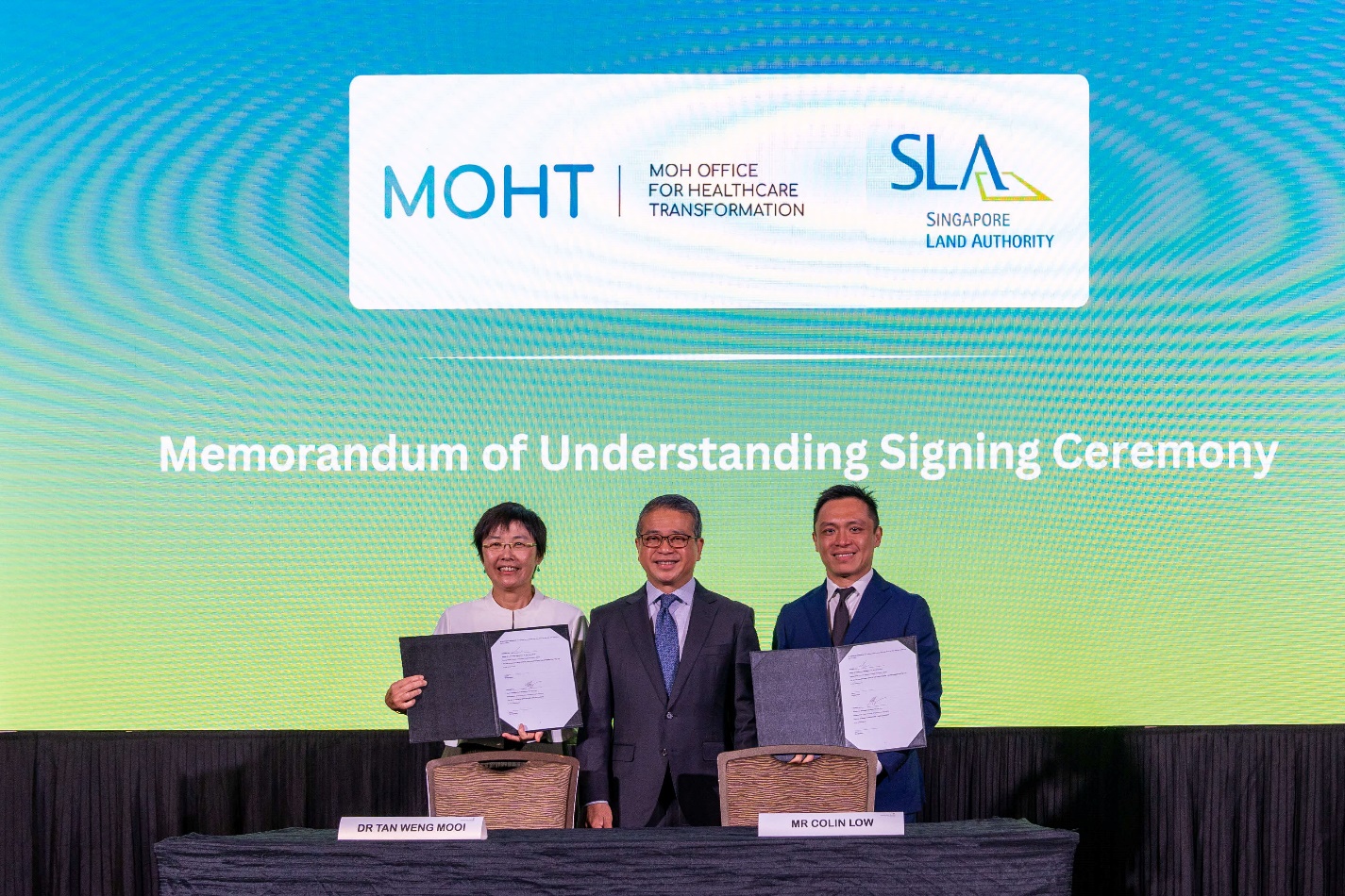
Mr Colin Low, Chief Executive of SLA (right), and Dr Tan Weng Mooi, Director (Integrated Health Promotion) of MOHT (left), signed a Memorandum of Understanding to expand the Digital Local Connect Network. The signing was witnessed by Mr Edwin Tong (centre), Minister for Culture, Community and Youth, and Second Minister for Law.
Quote
“Developed together with precinct leaders and community partners, DLC is a one-stop e-directory with consolidated information on health and social service providers in the precinct. Grassroots leaders, volunteers, community partners and general practitioners can leverage DLC to signpost residents to relevant support services and resources in their neighbourhood. This user-friendly platform supports collaboration and sharing of information among the partners to better service the community. Following the launch of DLC in Yio Chu Kang in December last year, MOHT is pleased to continue our partnership with SLA to harness geospatial and location technology to support social and healthcare services, to improve the coordination and support to residents, and help them better access and navigate care.”
- Dr Tan Weng Mooi, Director (Integrated Health Promotion), MOHT
Annex C
Screenshots of the barrier free access function on OneMap
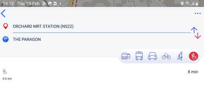
OneMap
OneMap
OneMap
Table 1 – Areas where barrier-free access routes have been mapped
1. Bukit Merah
2. Ang Mo Kio
3. Orchard
4. River Valley
5. Marina South (including Gardens by the Bay)
6. Museum District
7. Punggol
8. Singapore River
9. Tanglin
Annex D
Details of OneMap GPT Challenge Winning Prototypes
(i) Prototype 1 by Winner: Huawei International Pte Ltd
Inter-generational Itinerary Planner/Property Finder
Huawei’s prototype is among the first in the world that integrates geospatial and generative AI technologies with public (OneMap) and private sector data to develop an interactive inter-generational itinerary planner for residents to plan their daily activities or obtain information that can guide lifestyle decisions including consumer purchases.
The prototype developed by Applied Intelligence Centre of Excellence of Huawei International on Huawei Cloud integrates different types of data, such as property information (e.g. EdgeProp, ERA, Propnex), government information (e.g. OneMap datasets, Housing Development Board (HDB) housing policies, National Environmental Agency (NEA) weather information), mobility (e.g. SBS Transit, BlueSG, GetGo, AnyWheel), retail (e.g. Sheng Shiong, UOB TMRW) and lifestyle (e.g. Sentosa Development Corporation, National Library Board (NLB)) datasets.
The prototype can be extended to support other types of user queries, such as planning a day itinerary for property viewings based on specific user preferences, and recommending suitable properties for couples to reside near their parents.
Photograph of prototype 1
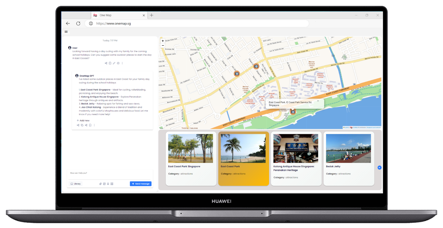
Photo credit: Huawei International Pte Ltd
About Huawei
Founded in 1987, Huawei is a leading global provider of information and communications technology (ICT) infrastructure and smart devices. We have 207,000 employees and we operate in more than 170 countries and regions, serving more than three billion people around the world.
Our vision and mission is to bring digital to every person, home and organization for a fully connected, intelligent world. To this end, we will work towards ubiquitous connectivity and inclusive network access, laying the foundation for an intelligent world; provide diversified computing power where you need it, when you need it, to bring cloud and intelligence to all four corners of the earth; build digital platforms to help all industries and organizations become more agile, efficient, and dynamic; and redefine user experience with AI, making it smarter and more personalized for people in all aspects of their life, whether they're at home, on the go, in the office, having fun, or working out. For more information, please visit Huawei online at www.huawei.com or follow us on:
http://www.linkedin.com/company/Huawei
http://www.facebook.com/Huawei
(ii) Prototype 2 by Winner: Buzz ARVR Pte Ltd
Tourist Buddy
The best way to travel and experience a new country is with a friend. In this case, a digital one. Introducing BuzzAR’s newest development - digital humans. BAE (Buzz's Amazing Entity) is an AI-powered digital human with emotions and expressions, interacting with customers and clients naturally to provide assistance, recommendations, and just good conversation.
BAE aims to create a seamless and interactive end-to-end travel experience for tourists, providing navigational assistance and travel guides to local attractions, restaurants, hotels and events. Imagine a companion, always within reach of your fingertips, providing you contextualised and personalised recommendations and suggestions, while paying attention to your needs and preferences, that is also able to carry a casual conversation about the things you see and the things happening around you.
BAE makes use of OneMap APIs for navigation, routing and display of map-based information. During the development, it also made use of some of OneMap’s open datasets, as well as recommendations from Singapore Tourism Board’s (STB) Tourism Information & Services Hub (TIH) platform. However a large bulk of recommendations from BAE come organically from OpenAI GPT4’s wide knowledgebase. BAE is able to support tourism-related queries, including recommending and planning a customised tourist itinerary based on individual user profiles and preferences.
BuzzAR believes that the next wave of immersive digital experiences in tourism, hospitality and real estate start with these digital humans.
Photographs of prototype 2
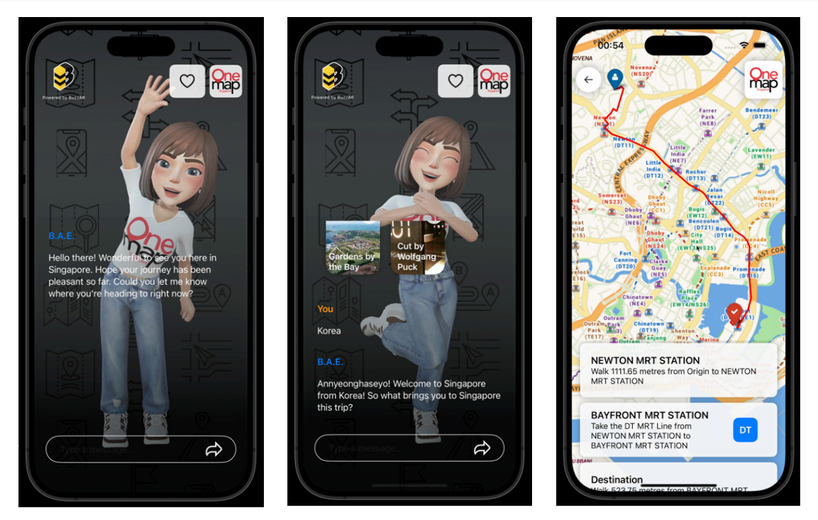
Photo credit: Buzz ARVR Pte Ltd
About Buzz ARVR
BuzzAR – digitizing people, places and payments, and transforming customer interactions. BuzzAR is an AR, VR and AI solutions company developing products that enhance customer experiences for tourism and retail in Singapore and Saudi Arabia. Founded in 2018 by co-founders Bell Beh and Ken Lim, they have since worked with over more than 10 B2B/B2G clients and partners with over 100 companies in their ecosystems. Key products include their AR Wayfinder platform, an interactive kiosk that interacted with customers and digitised faces, and their work on LLM-based AI chatbots and self-hosted LLM solutions.
BuzzAR was part of the Singapore Tourism Accelerator in 2020, and the Saudi Tourism Accelerator in 2022 (hosted by Singapore Tourism Board and Saudi Tourism Authority respectively), as well as the recent Google AI Trailblazers programme.
Annex E
Other event highlights
Closing Plenary – Thursday 7 March 3.40pm to 5pm
Mainstreaming Geospatial: Harnessing Geospatial Innovation for Healthcare, Community and Sustainable Development
Jointly hosted by Mr Colin Low, Chief Executive of SLA and Mr David Foo, Chief Executive of MPA, this panel discussion explores the strategies, challenges, and opportunities for making geospatial data and technology more mainstream in sectors such as healthcare, social and sustainability, to enhance the quality of life for citizens and promoting sustainable development.
The discussion will delve into the following key areas:
Healthcare: Investigating the potential applications of geospatial in managing public health and healthcare delivery. How can geospatial contribute to better understanding of healthcare needs, optimise resource allocation, and improve health outcomes?
Social/Community Development: Examining the role of geospatial in community development, engagement and the provision of social services. How can geospatial be leveraged to improve access to essential services, enhance social cohesion and promote a more inclusive community?
Sustainability: Exploring the intersection of geospatial with sustainability initiatives, including environmental conservation, biodiversity protection and enhancing the resilience of our land and marine spaces. How can geospatial better support sustainable development and climate resilience efforts?
Distinguished Panellists:
Co-host: Mr Colin Low, Chief Executive, Singapore Land Authority
Co-host: Mr David Foo, Assistant Chief Executive, Maritime and Port Authority of Singapore
A/Prof Gan Wee Hoe, Chief Executive Officer, SingHealth Community Hospitals
Mr Jack Lim, Managing Director, Community Chest
Dr Cheong Wei Yang, Vice Provost (Strategic Research Partnerships), Provost Office, Singapore Management University
Dr. Jani Thuaibah Isa Tanzil, Senior Research Fellow, Tropical Marine Science Institute, National University of Singapore
Launch of Heavy Vehicle Routing API
Following an MoU signed with the Container Depot and Logistics Association (Singapore), or CDAS, last year, SLA has completed the development of the routing algorithm on OneMap for the western part of Singapore (Pasir Panjang – Tuas) with CDAS’ heavy vehicle traffic data, to enable the CDAS' member companies to route their heavy vehicles efficiently and safely.
To-date, CDAS has developed a prototype on their system allowing drivers to opt for safer routes that accommodate their vehicle’s height and width constraints. With more comprehensive data, the routing algorithm is expected to improve driver safety, reduce fuel and time wastage, increase transportation efficiency and optimise operations.
ASEAN Geospatial Challenge 2024
At the opening of the Geo Connect Asia 2024, Mr Colin Low, Chief Executive of SLA, presented the “Distinction Award” to the winning teams of the ASEAN Geospatial Challenge 2024, which was organised by SLA.
The annual ASEAN Geospatial Challenge brings youth in the ASEAN region together to use geospatial technology and information to support nations in achieving their Sustainable Development Goals (SDGs). Targeted at students from Institutes of Higher Learning (IHLs) in the ASEAN region, the challenge aims to cultivate good relationships and collaborations among the youth in ASEAN, elevate geospatial competencies and facilitate knowledge sharing to raise the overall interest in the geospatial field.
A total of 49 teams from IHLs across four ASEAN countries participated in the competition this year. There were 8 teams from Singapore, 37 teams from Indonesia, 3 teams from The Philippines, and 1 team from Thailand.
The two winning teams of the “Distinction Award” are from the University at Buffalo – Singapore Institute of Management, and Bandung Institute of Technology, Indonesia. The synopses of the projects from the teams are appended.
University at Buffalo – Singapore Institute of Management
The team’s project seeks to revolutionise food waste management in Singapore by utilising geospatial data, combining statistical and advanced geospatial techniques to map and predict food wastage patterns.
Bandung Institute of Technology, Indonesia
The team’s project aims to create a platform that integrates geospatial data to address the critical issue of Asian elephant habitat loss due to deforestation for oil palm plantations in Indonesia.
For more information about the challenge, please visit: ASEAN Geospatial Challenge 2024 (sla.gov.sg)