
Feature Articles
#SLAExplains: Mapping a Nation — The Story of OneMap
21 November 2025
An interview with Mr Ng Siau Yong, SLA's Director of Geospatial and Data, and Chief Data Officer

Most of us open our phones to check the weather, traffic, or directions — often through commercial apps built for the world. But behind many of Singapore’s government services lies a quieter engine: OneMap, the homegrown national map that powers essential tools from public amenities to land information systems.
Launched in 2010, OneMap is Singapore’s national map — a trusted, government-backed platform that integrates data from over 65 public agencies. It has evolved from a static web map into today’s comprehensive platform. Behind this transformation is a compact but dedicated team led by Mr Ng Siau Yong.
We sat down with him to learn how OneMap came to life, how it continues to evolve, and what lies ahead for Singapore’s authoritative map.
How did OneMap start, and what sparked the inspiration behind it?
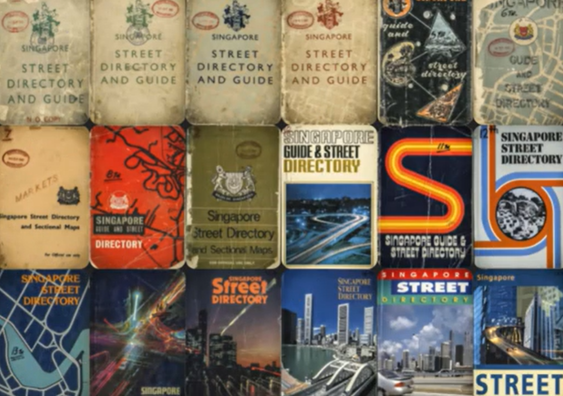
The predecessors of OneMap – physical street maps of Singapore
OneMap began as a simple idea with a big purpose — to put trustworthy local information in one place for everyone. In the early days, SLA licensed the data to printers and hard-copy maps were produced. But as the world moved online and digital maps began transforming how people navigate, our team asked a key question: how can we give Singaporeans reliable, government-backed information they can actually use every day?
The answer became clear — Singapore needed an authoritative, national map that everyone could access, from individuals to agencies and businesses. To meet that need, we made fundamental map information freely available and accessible online. OneMap 1.0 was born in 2010, a web-based platform that brought together geospatial data from across the government and with the aim to create a spatially-enabled nation.
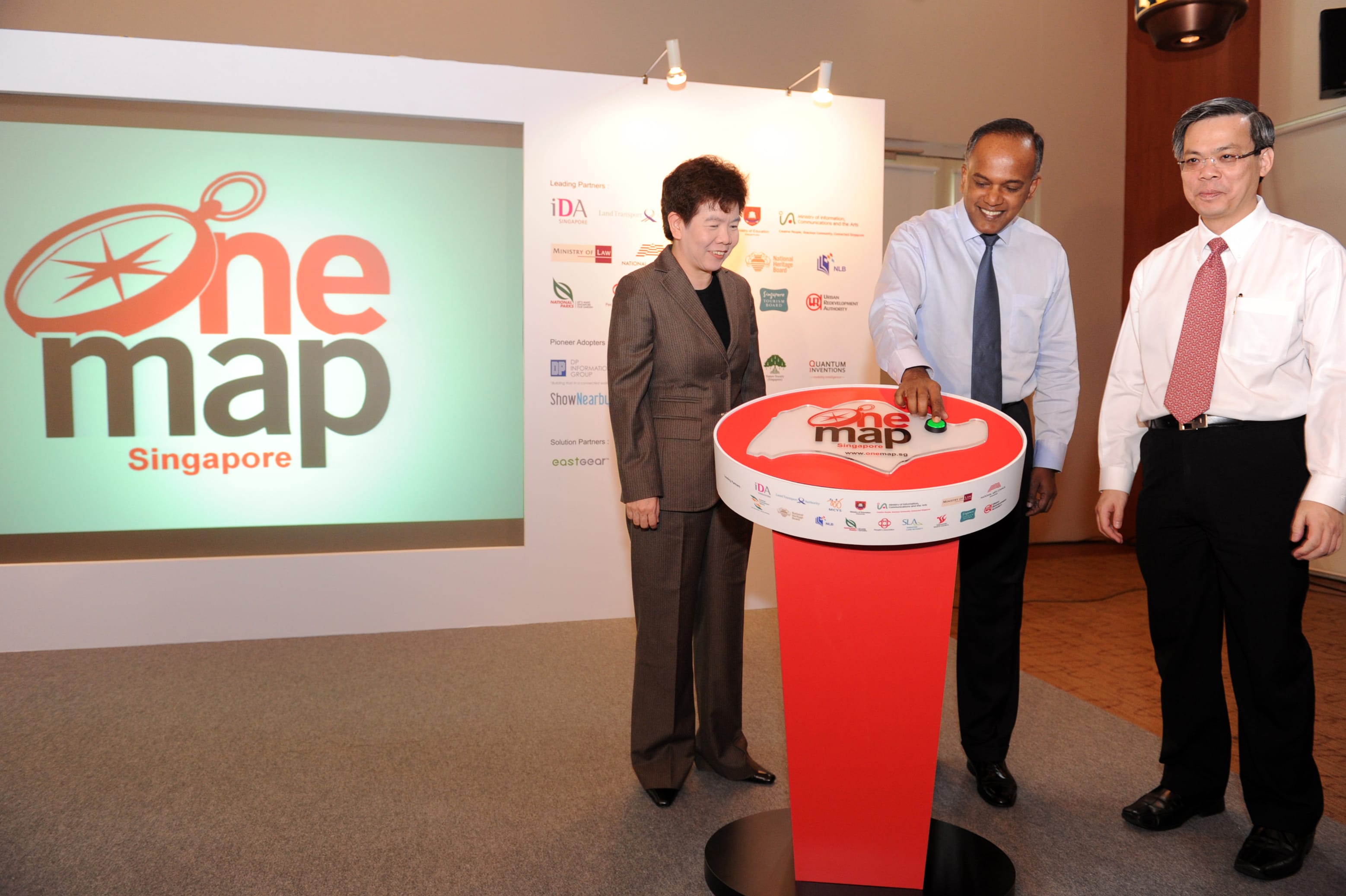
OneMap was launched in 2010 by Mr K Shanmugam (middle), Coordinating Minister for National Security and Minister for Home Affairs, then Minister for Law, Ms Chan Lai Fung (left), then Permanent Secretary (Finance Performance) of Ministry of Finance and Mr Chan Yeng Kit, then Permanent Secretary of the former Ministry of Information, Communications and the Arts (MICA)
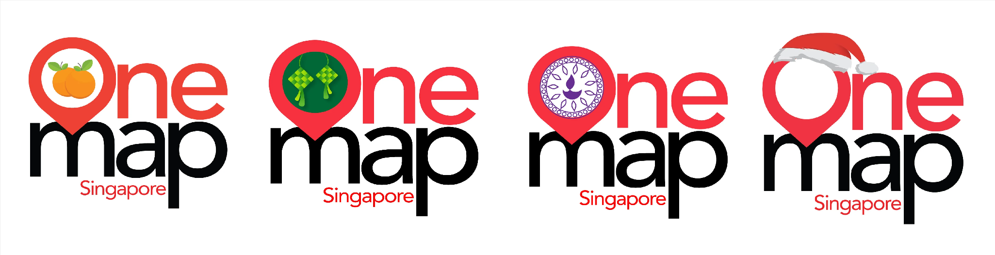
True to its focus on being local, OneMap’s logo was refreshed on the social platforms to reflect our multi-cultural community during Singapore’s four major festivals
Since then, OneMap has continued to evolve with technology and community needs — a platform born of collaboration, rooted in local realities, and designed to stay local, granular, authoritative, and up to date.
Sounds like a noble feat! How has OneMap changed over the years?
The early focus was on recreation and culture — parks, heritage trails, and public amenities — before expanding to cover essential services like healthcare, education, and transport. Over time, OneMap evolved alongside technology and user needs, and after 15 years, we are now at Version 4.0.
Each version reflects how Singapore has grown as a smart nation — more connected, data-driven, and focused on improving daily life through geospatial insight. Version 5 is coming soon, so do look out for that!
In what way is OneMap different from commercial maps, especially for everyday Singaporeans?
Unlike commercial maps, OneMap isn’t driven by ads or commercial partnerships. We are public service–focused and that’s what truly sets us apart.
Most importantly, OneMap is built for the public good. It prioritises functions that matter in daily life, such as healthcare, social services, schools, parks, and public amenities.
Think of it as a trusted and comprehensive guide to your neighbourhood — local, citizen-focused, and free of commercial clutter, a map made for Singaporeans, by Singapore.
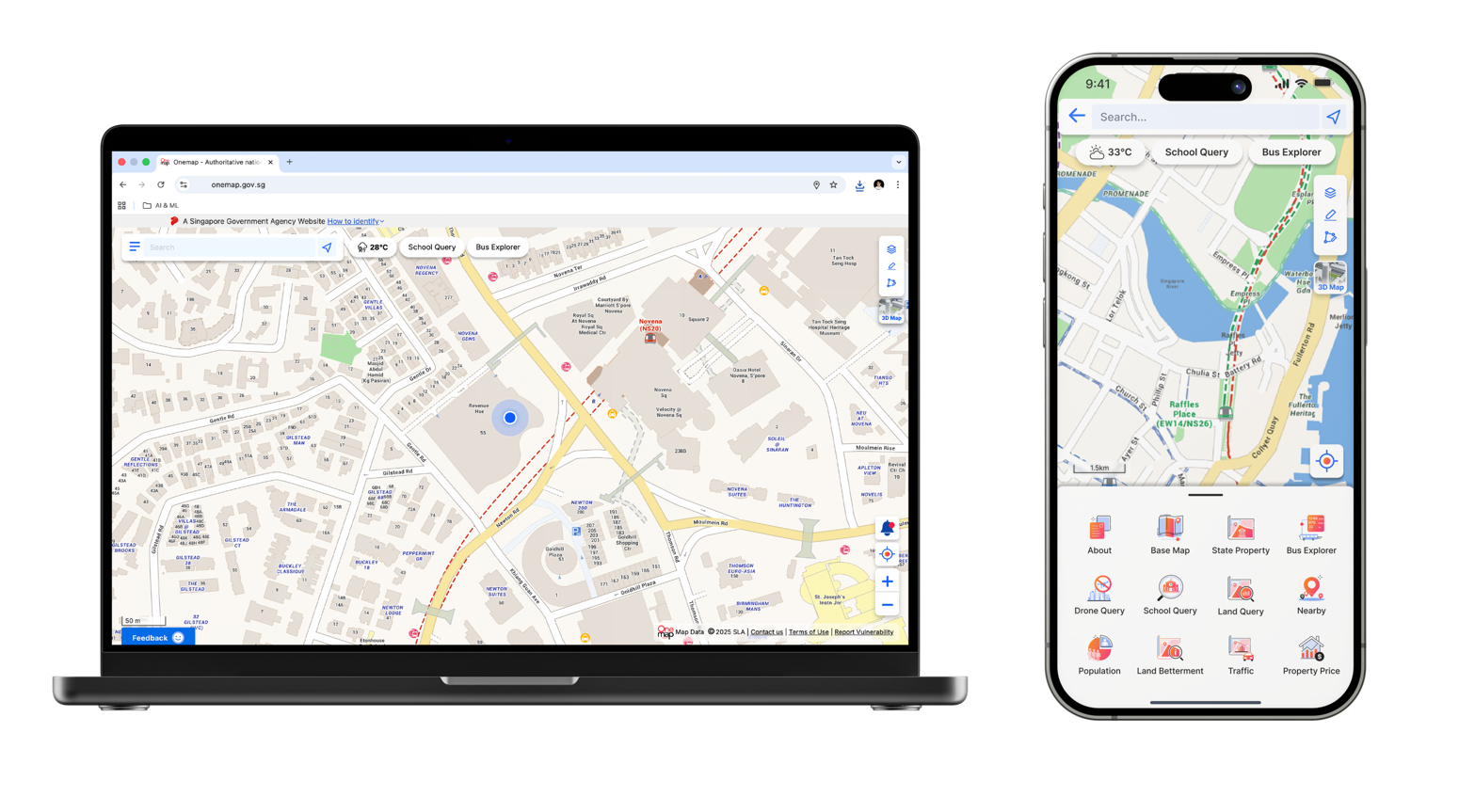
OneMap is available on both desktop and mobile versions
How does SLA keep OneMap useful and relevant for daily users?
Since we work with many government agencies on different citizen-centric services, OneMap adopts a multi-window approach —while each agency provides its location-related data and services through its websites and apps, OneMap provides another channel where many of these come together. The result is a trusted, government-backed map that brings hundreds of datasets together into one clear, unified view.
Of course, with so many partners involved, keeping everything updated is a constant effort. It’s all about rhythm and relationships. Agencies maintain their own data, and our team ensures it’s harmonised and made accessible to the public on OneMap.

The OneMap team holds API Workshops to explore Singapore's whole-of-government mapping platform, which also serve as stakeholder engagement sessions with the industry and community
Our small in-house team manages a weekly cycle of updates, checks, and coordination with dozens of agencies. We also listen closely to users through surveys and engagement sessions to understand what’s truly useful on the ground — whether that’s finding the nearest clinic, library, or park. The goal is simple: to keep OneMap a tool that people naturally turn to in their everyday lives.
Who’s responsible for keeping OneMap’s data accurate and up to date?
Accuracy is everyone’s responsibility. Each agency owns and updates its own datasets, and OneMap acts as the central steward — ensuring that data flows smoothly, passes validation checks, and stays consistent across the board.
We like to say that we serve the agencies that serve citizens. In many ways, we’re the Geospatial Trusted Centre — the quiet backbone supporting government services that make daily life simpler for everyone.
What’s one feature or piece of fun fact on OneMap that might surprise people?

Most people are surprised to learn that a small in-house team — just about 10 of us — manages coordination across so many government agencies.
Second, OneMap is more than checking ownership of land parcels (LandQuery is arguably the most well-known function in the app). The drive toward hyperlocal data—neighbourhood-level details like park kiosks, local shopping centres, and community amenities—shows how local-focused and practical OneMap can be. And third, living asset data and social/healthcare layers (like dementia services and related facilities) highlight a mission beyond traditional mapping, which is to use data to support real community needs.
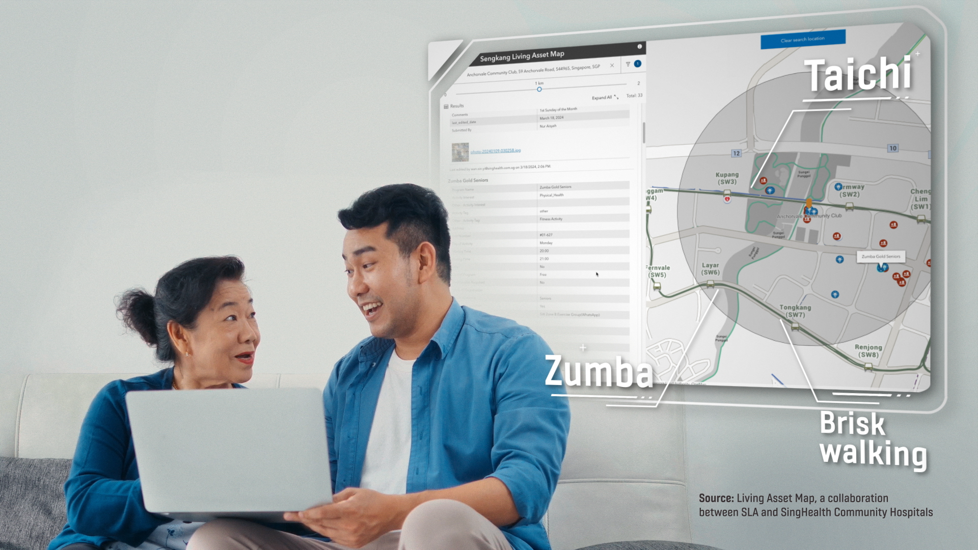
The Living Asset Map pioneers preventive healthcare for a healthier future
Many also don’t realise that OneMap quietly powers many government services they already use. When you check resale flat listings on the HDB website, submit feedback through the OneService App, or browse URA’s planning maps —OneMap is actually serving you in the background too.
Not to mention finding the nearest stores or neighbourhoods you can use your CDC vouchers, view electoral boundaries during elections, and more recently, we are working with stakeholders to make crowdsourced locations of delivery waiting bays publicly available on OneMap, to help delivery personnel find appropriate parking locations.
In fact, about 67 government agencies use OneMap for their services. You can say we are a collator of sorts.
What are the key challenges OneMap faces, and how did your team address them?
The toughest part is connecting the dots across agencies — everyone has their own systems, timelines, and priorities. Add to that the challenge of keeping data fresh with a lean team and limited resources.
We address that through trust and teamwork: a collaborative governance model, a “many windows, one view” architecture, and ongoing engagement with our partners. It’s not easy, but it’s what keeps OneMap credible and relevant. Collaboration really is the heart of it all — we couldn’t do this without the strong support of our partner agencies.
Another challenge is the rapid rise of AI. Technology is evolving fast, so we’re exploring ways to integrate AI into OneMap. With a tight in-house team, we rely on both external expertise and training our staff to harness AI effectively.
Looking back these 15 years, what are you most proud of for OneMap?
OneMap has always been about making life better for people. I’m especially heartened on how we’ve used geospatial for good.

In September 2024, SLA officers guided NUS staff on how to map BFA routes in the NUS, West Coast and Clementi vicinity
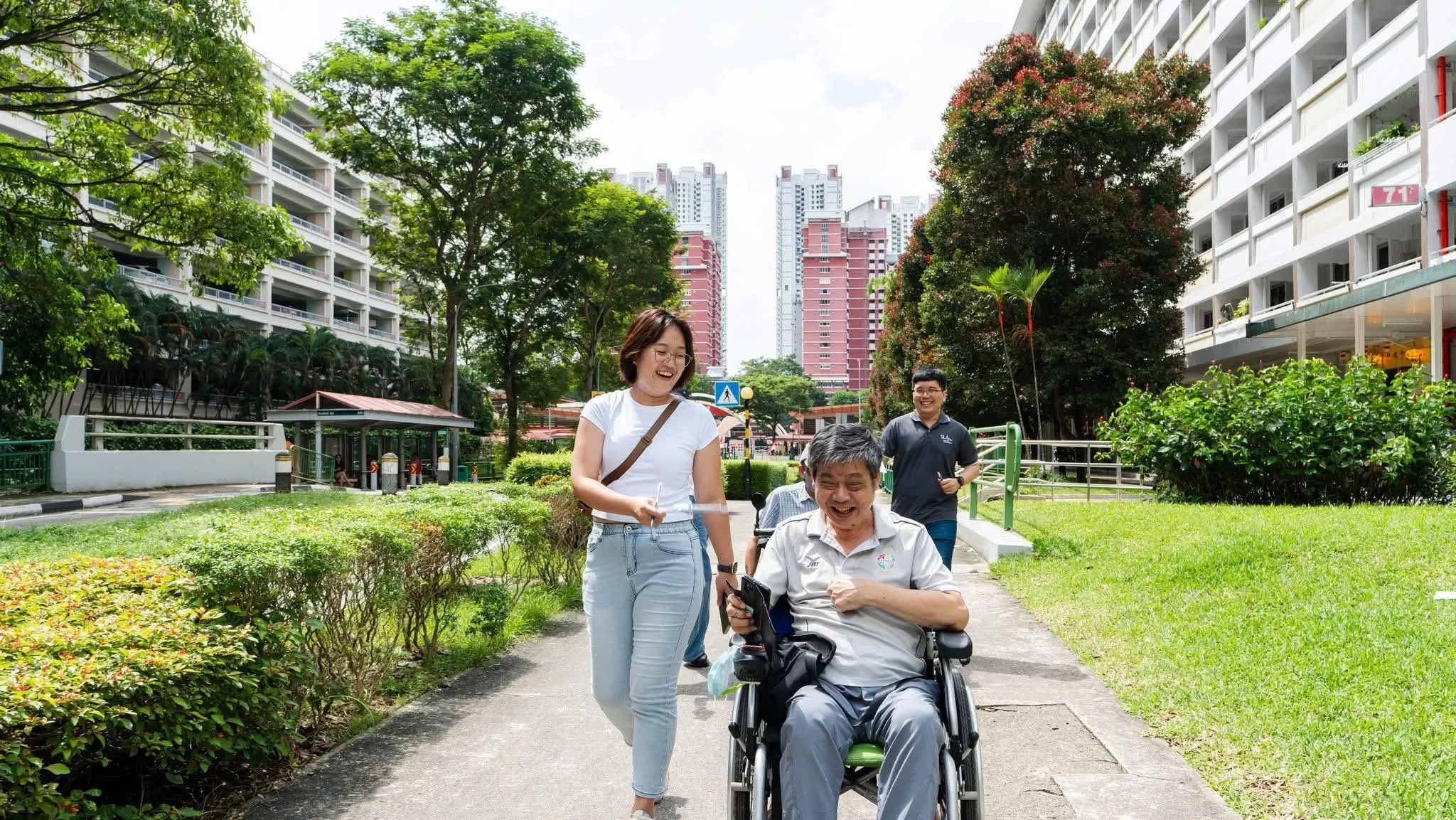
Take our Barrier-Free Access (BFA) routing feature, for example. What began with 1,000 km of accessible paths in nine areas — like Bukit Merah, Ang Mo Kio, and Orchard — has now expanded by an additional 5,000 km across Singapore. OneMap even turned purple recently in October 2025 to support the Purple Parade, highlighting SLA’s efforts in inclusion and celebrating ability.
Developed with various partners, BFA helps wheelchair users, parents with strollers, and seniors navigate safely via ramps, lifts, and covered walkways. We’re expanding it island-wide, including thousands of accessible paths near transport nodes with SBS Transit, and moving indoors through a tripartite MoU with SG Enable and REDAS. Regular user testing ensures the project remains responsive to community needs — it’s all about first-and-last-mile inclusion.
What other initiatives are you proud of that go beyond traditional mapping?
Another project close to my heart is the Living Asset Map (LAMP), co-developed with SingHealth Community Hospitals (SCH). It connects residents to community assets like active ageing centres, exercise groups, and volunteer activities — supporting social prescribing and preventive healthcare. LAMP even won the ESRI GeoInnovation Award 2024 as well as Singapore’s Ministry of Health’s National Medical Excellence Awards 2024.
Social agencies are also using OneMap in innovative ways. For example, at GeoEngage 2025: Socio-Healthcare Edition, over 170 participants explored how geospatial insights can enhance social service delivery.
Viriya Community Services created an interactive map to understand residents’ bio-psycho-socio-emotional needs, enabling more targeted support like financial aid, counselling, and mental health programmes.
Dementia Singapore developed CARA, a digital community platform that uses location intelligence to trace missing dementia patients safely, mapping over 800 “Go-To-Points” across Singapore. This allows families and caregivers to have peace of mind, knowing that trained staff can quickly assist those in need.
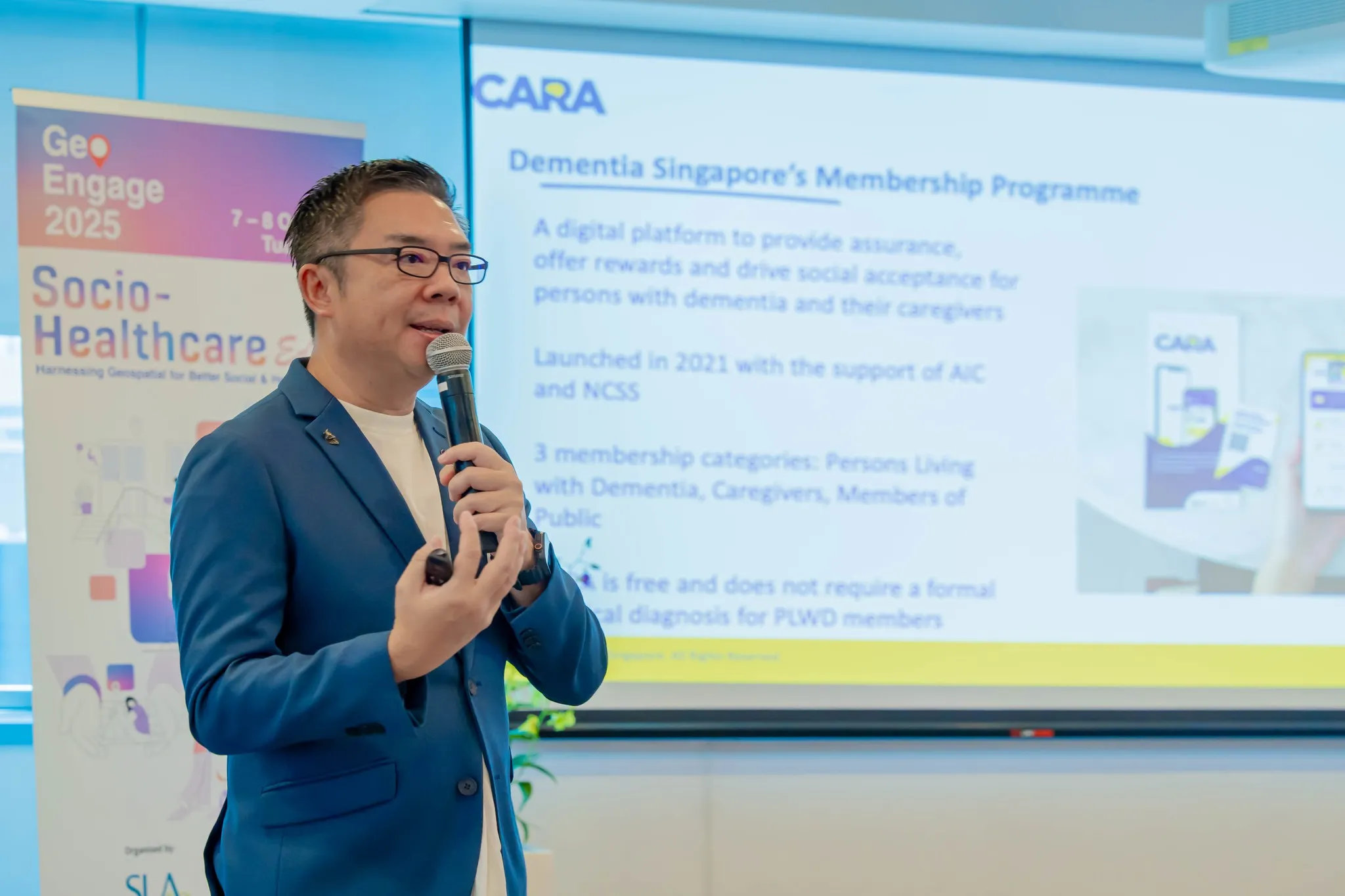
Dementia Singapore’s Mr Bernard Lim at GeoEngage 2025 presenting the CARA App for individuals with dementia and their caregivers
These initiatives show that OneMap is more than just navigation — it’s helping people live healthier, safer, and more connected lives.
What’s next for OneMap?
The future is about deeper usefulness for everyday life.
We’ll expand social and healthcare-oriented layers, push for more hyperlocal data, and explore AI-assisted search to help people discover what they need faster.
Barrier-free access will stay a priority, and we’ll keep OneMap as a central, authoritative public map that grows with community needs—from clinics and schools to parks and neighbourhood services—without losing its local soul.
The OneMap Journey
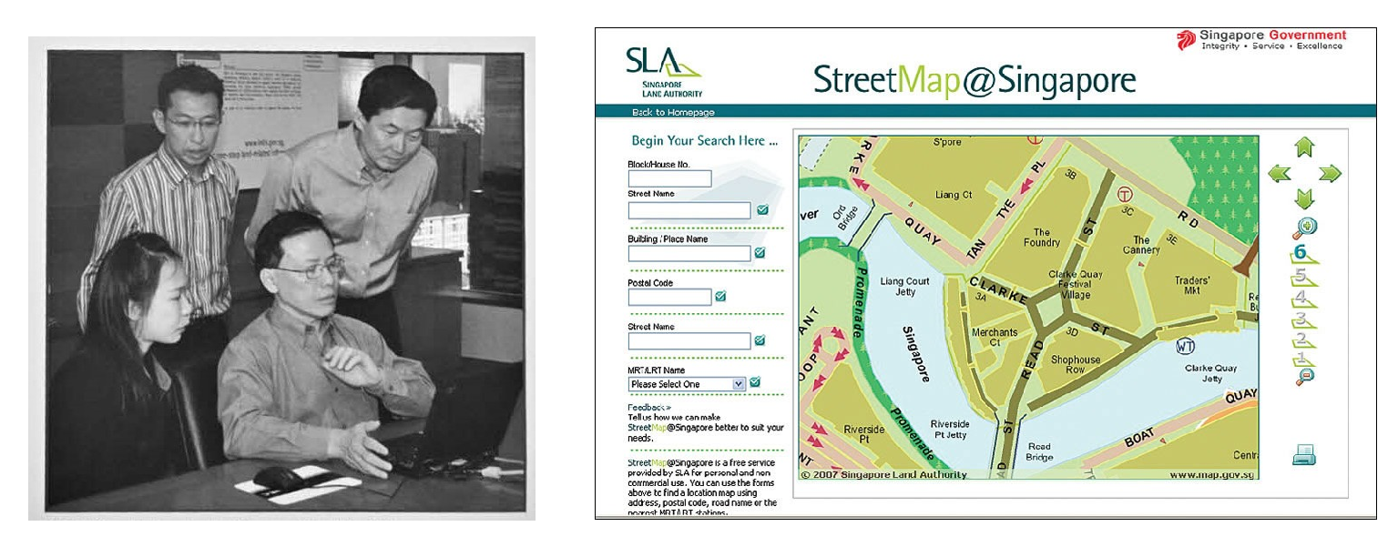
Mr Ng (in stripes) was at the launch of LandQuery and StreetMap@Singapore with then Senior Minister of State for Law and Home Affairs, Mr Ho Peng Kee (seated and in glasses)
2006
22 Nov 2006 - The great grandfather of today's OneMap began with StreetMap@Singapore, which was launched on this date and offers a simple and quick way to search for location information. Users are able to search using five different search keys and download maps for personal and non-commercial use.
Another service made available for free to the public was LandQuery, a comprehensive database of public land ownership. It provides information on whether the land is State or privately owned, contact details of the public agency responsible for a particular piece of land or its managing agent and the land boundaries and lot numbers.
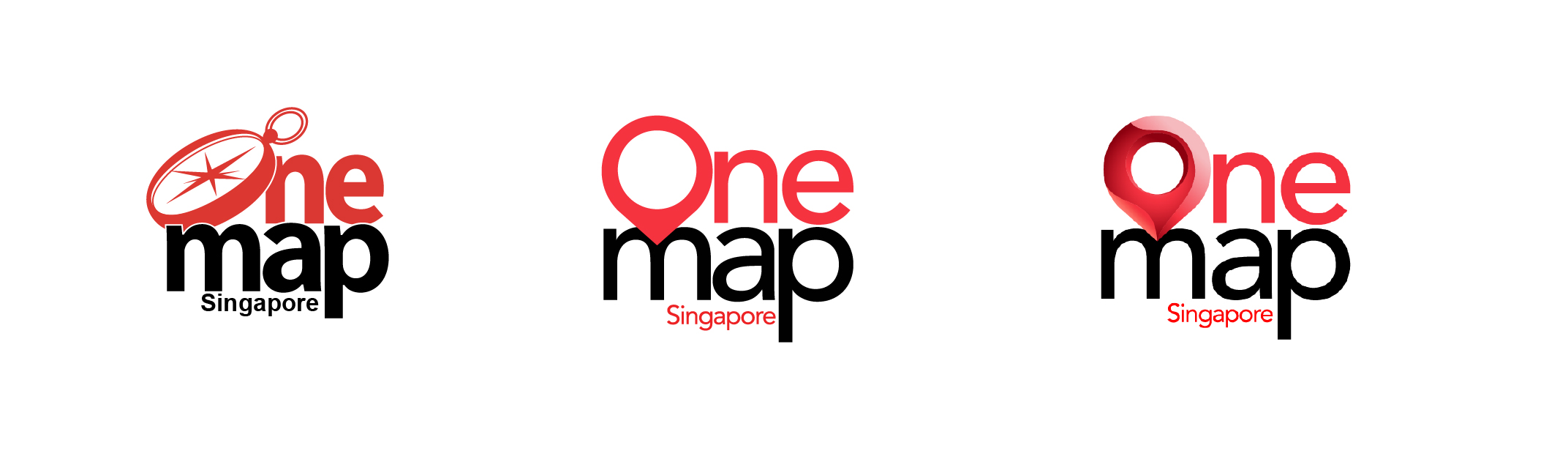
The evolution of OneMap logos – the very first version in 2010, the second version in 2015 and the 3D Maps version in 2019. The current app and website now uses the middle logo
31 Mar 2010
OneMap 1.0, a web-only platform integrating multiple agencies’ datasets, was launched.
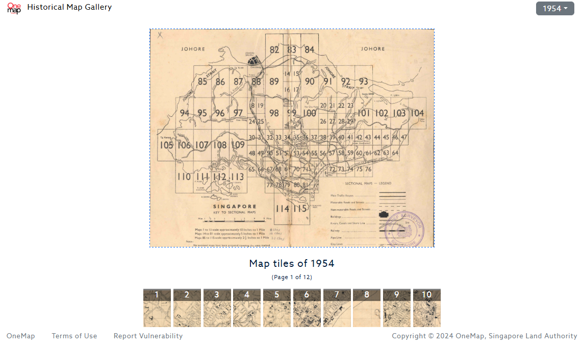
The current iteration of the One Historical Map, which offers viewers the map (and map tiles) of Singapore since 1954
2014 - 2015
Oct 2014 – OneMap wins Silver at ASEAN ICT Awards for Digital Content in Bangkok, recognising ICT advancement and achievements
Dec 2015 – One Historical Map was rolled out, allowing users to compare Singapore’s streetscape with five maps dating back to 1966
2017
Jul – OneMap IdeaWorks! was launched to co-develop geospatial solutions with technologists, data scientists, and community organisations
Oct – OneMap 2.0 goes web and mobile, bringing maps to users on the go; includes multi-mode journey planner with walking routes that provide the shortest routes, most sheltered walkway and safe pedestrian crossings
2018
Jul - GeoWorks industry centre opens to promote geospatial innovation and competencies
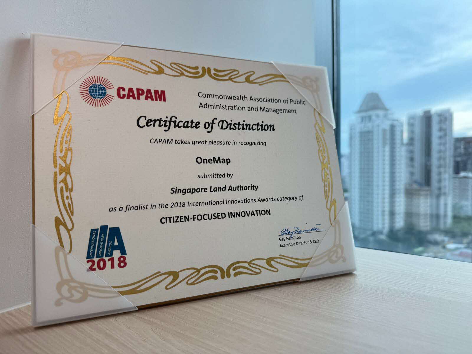
Oct – OneMap is a finalist at the Commonwealth Association of Public Administration & Management (CAPAM) 2018 International Innovations Award (IIA) for the category of Citizen-Focused Innovation. The award celebrates the spirit of innovation in the public service by recognising organisations that have made significant contributions to improving governance and services in the public sector.
SLA and the Singapore Business Federation signed a MoU in 2022 to harness the potential of geospatial applications across industries
2019 - 2022
Sep 2019 – OneMap introduces 3D maps and developer APIs
Apr 2021 – MoUs with Ninja Van, Kabam, and PropNex enable collaborative geospatial innovation in delivery, robotics, and real estate
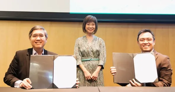
Oct 2022 – SLA and Singapore Business Federation's MoU accelerates geospatial tech innovation and co-innovation projects for business challenges
An additional 5,000 km of Barrier-Free Access routes are slated to be added on OneMap
2024 till present
Mar 2024 – Launch of Integrated OneMap, combining 2D, 3D, and thematic data
Mar 2024 – Inaugural OneMap GPT Challenge (winners: Huawei and BuzzAR), launch of Barrier-Free Access (BFA) routing, Living Asset Map (LAMP) partnership with SingHealth Community Hospitals
Nov 2024 – Tripartite MoU signed between SLA, SG Enable, and REDAS to extend BFA mapping from outdoor to indoor spaces
Apr 2025 - Expansion of BFA routes from 1,000 km to an additional 5,000 km, as well as expansion of LAMP to more precincts in Singapore