#SLAExplains: The Lines that Define Singapore—Surveying the Spaces Above, Below and Around Us
21 August 2026
An Interview with Dr Victor Khoo, Director of Survey & Geomatics and Chief Surveyor of Singapore
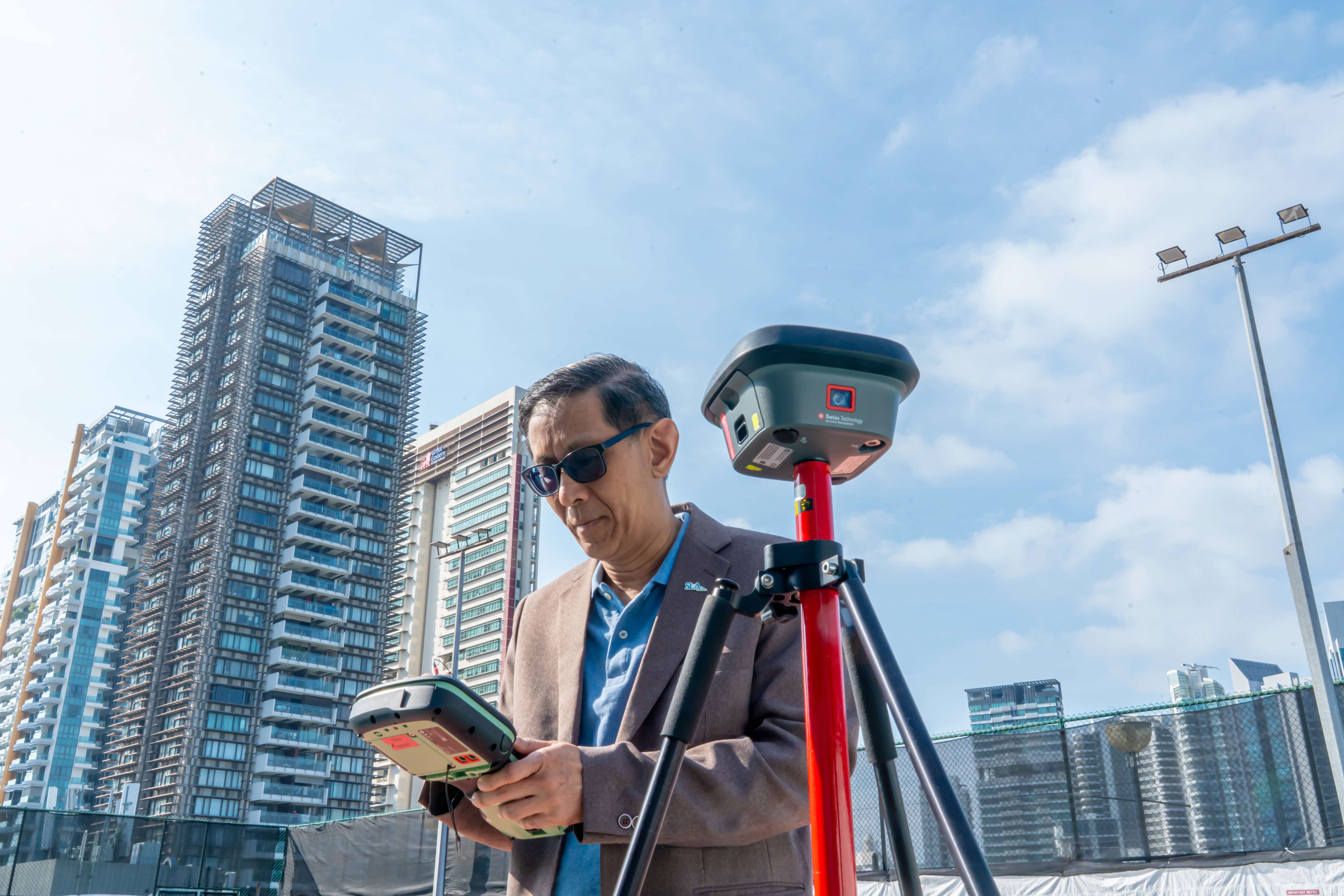
From defining property boundaries to mapping Singapore above and below ground, surveying is work that often goes unseen but underpins how the nation plans, builds and grows. As technology reshapes the profession, one thing remains constant: the need for authoritative geospatial information that Singapore can trust — today and into the future.
In this instalment of #SLAExplains, we speak with Dr Victor Khoo, Director of Survey & Geomatics and Chief Surveyor of Singapore, about the evolution of Singapore’s geospatial capabilities, his work with the United Nations to advance geospatial and land administration practices internationally, and how emerging technologies such as GEOAI are shaping the way we understand, map and plan our limited space.
When you look at Singapore, what does a surveyor see that the rest of us may not?
Victor: Perhaps the first thing I see is that almost everything around us depends on knowing precisely where things are.
Every property has a boundary. Every road, building and piece of infrastructure occupies a defined space. Beneath our feet is another complex landscape of utilities and infrastructure that also needs to be understood and mapped.
As Chief Surveyor, I work with a team that helps establish the precise locations, boundaries and geospatial information that underpin how land in Singapore is defined, registered, developed and managed.
How does surveying help us understand and manage Singapore as a whole?
Victor: Surveying has been part of Singapore’s story from the very beginning. When Raffles established the colony, the land survey department was the first department he created, and William Farquhar completed a comprehensive survey of the settlement by 1820. More than two centuries later, the tools have changed dramatically, but that fundamental need for precision remains.
Today, SLA maintains the systems, standards and datasets that support roughly 1.6 million apartments and 147,000 land parcels, as well as the increasingly complex spaces beneath them. Every plot has a unique identification lot number, every boundary carries legal significance, and every measurement matters.
Underlying all this is Singapore’s geodetic and Global Navigation Satellite System, or GNSS, infrastructure — the network of precise reference points and coordinate systems from which surveys, maps and geospatial datasets across Singapore are derived.
Our work also extends to national mapping. We maintain authoritative representations of Singapore’s terrain, buildings, waterbodies and coastlines, and increasingly, three-dimensional digital models of our built environment.
So when I look at Singapore, I see more than what is visible on the surface. I see the geospatial framework that holds it all together.
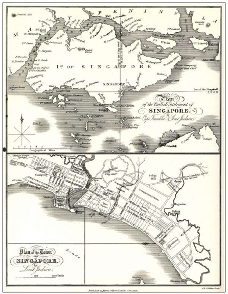
1828 Town Map of Singapore surveyed by William Farquhar (taken from History of Singapore Survey Department, 1819-2024, by Mok Ly Yng)
What is the role of a Chief Surveyor?
Victor: It is a role that many may not have heard of, but this area of work quietly shapes almost every aspect of how the country is built, governed and lived in.
The Chief Surveyor is a statutory appointment under the Boundaries and Survey Maps Act. In practical terms, every cadastral survey plan submitted by a registered surveyor in Singapore must receive the Chief Surveyor’s approval before it becomes part of the nation’s authoritative land record.
A land boundary is not simply a line on a map. It defines where one person’s rights to land end and another’s begin. Before land can be registered, transacted, managed or developed, we need to know exactly where it is and what it encompasses. That is the role of cadastral surveying: to define each parcel precisely, provide legal certainty for transactions and establish the authoritative foundation on which our land administration system rests.
This impact is wider than many people realise. Cadastral surveying enables property markets to function, supports land taxation and administration, allows banks to extend credit against land and property as collateral, and gives planners and developers the certainty they need to build.
So when you buy a flat, plan a road, build a school or dig a trench, you are — knowingly or not — relying on data that flows from this system.
There is a great responsibility in maintaining that trust. My role is to make sure that the standards and records behind it remain authoritative, accurate and dependable.
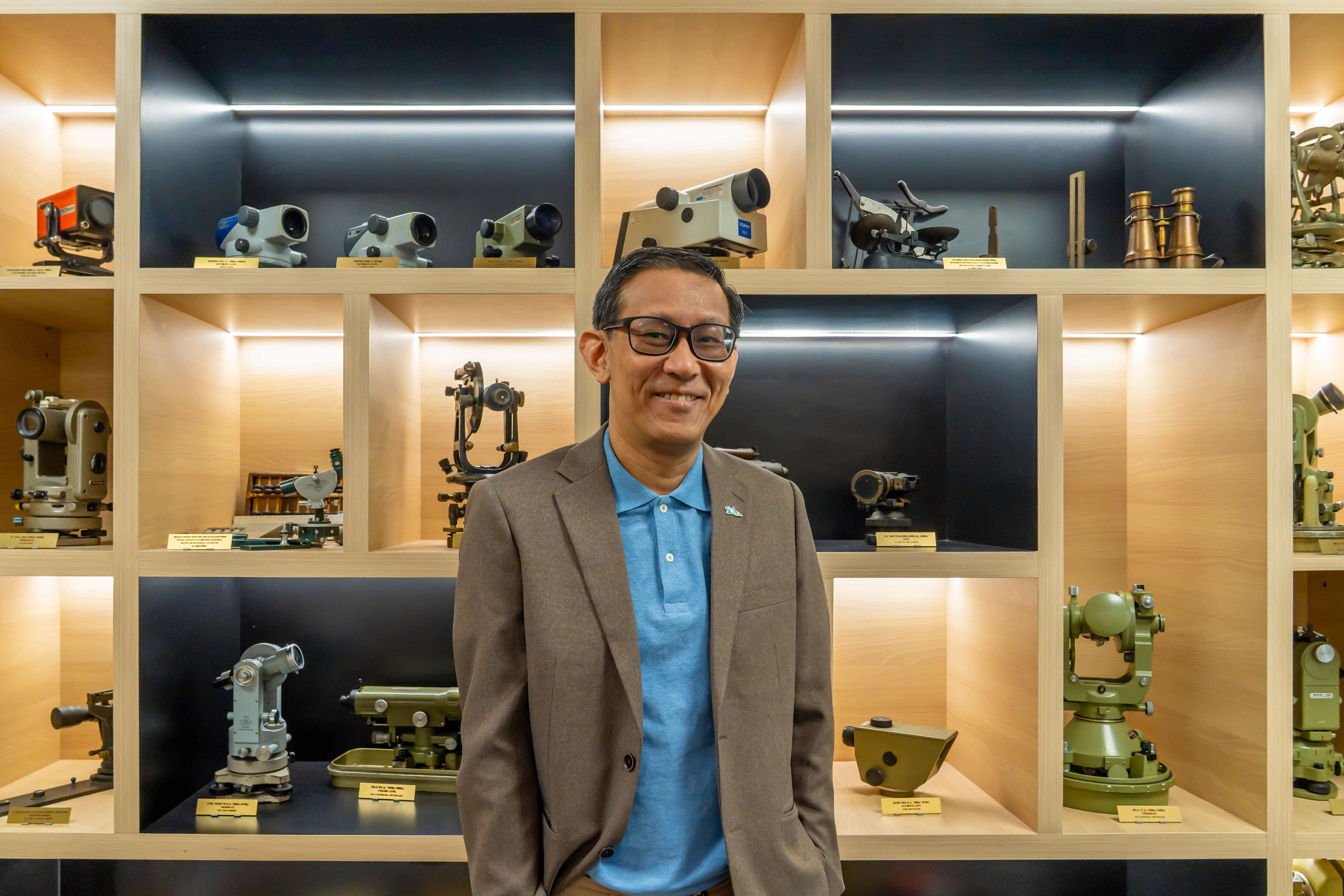
Chief Surveyor and Director of Survey & Geomatics Dr Victor Khoo with a display of vintage and modern survey equipment dating from 1850s to 2010s
How does Singapore manage land surveying?
Victor: Singapore’s approach to cadastral surveying is a public-private endeavour. When the Land Surveyors Board was established in 1970, a deliberate decision was made for on-the-ground cadastral surveys to be carried out by registered private surveyors. More than five decades later, I believe that model has served Singapore well.
Registered surveyors undertake the fieldwork — subdividing plots, establishing boundaries and documenting new developments according to the needs of each project. Their cadastral survey plans are then submitted to SLA, where I review and approve them before the data enters the national record. SLA provides the governance, standards and authoritative national datasets.
Is surveying just about measuring Singapore’s land?
Victor: People often think surveying is mainly about measuring distances and drawing maps. Measurement is certainly fundamental, but cadastral surveying requires much more. A surveyor may need to interpret historical documents, resolve ambiguities in old records, understand property law and exercise professional judgement in genuinely complex situations.
Consider a piece of land that has undergone several boundary changes over many decades. Historical information may be incomplete, or older measurements may have been made using reference systems very different from those we use today. The surveyor has to reconcile all of that evidence with current measurements.
The stakes can also be significant. Boundary accuracy has direct legal and financial consequences for property owners. If a dispute arises — for example, where one property appears to encroach onto another — the resolution begins with the authoritative cadastral and ownership information that SLA holds.
That is why precision matters, but so do judgement, professional integrity and an understanding of the history behind the numbers.
How does Singapore enable precision positioning?
Victor: As Singapore embraced digital transformation, there was a growing need for a modern and highly accurate positioning system that could support rapid urban development and the emerging digital economy.
I had the opportunity to lead the development of Singapore’s national satellite-based precise positioning infrastructure. The objective was to provide government agencies, surveyors, engineers and industry with a consistent, reliable and nationally unified reference framework.
Established by SLA in 2006, the Singapore Satellite Positioning Reference Network, or SiReNT, provides the authoritative positioning infrastructure for national mapping, engineering surveys, construction, infrastructure development and geospatial data integration.
In practical terms, SiReNT has transformed the way surveying and positioning work is carried out. Surveyors can determine precise positions much more efficiently in the field, rather than relying solely on traditional methods that may require considerably more time and manpower.
What is particularly exciting is how its applications have grown beyond surveying and mapping.
SiReNT supports smart construction through precise machine guidance, digital engineering and structural deformation monitoring. Its centimetre-level positioning services can also provide an important foundation for autonomous mobility, unmanned aerial systems, robotics and intelligent transport systems.
Increasingly, we are also using precise positioning to monitor land movement, infrastructure deformation and environmental change over time.
So while SiReNT began as national positioning infrastructure, its role has evolved. Today, I see it as an important part of Singapore’s wider geospatial infrastructure — one that supports sustainable development, operational resilience and future innovation.
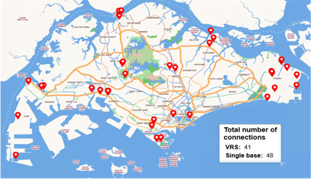
SiReNT dashboard showing the location of real-time users of the precise GNSS positioning in Singapore
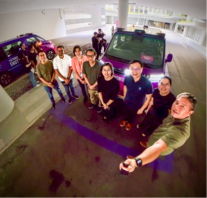
The SiReNT team at the Autonomous Shuttle Trial in Punggol. SiReNT's centimetre-level positioning services provide a key enabler for autonomous vehicle technologies in Singapore
Was there a project that changed the way you thought about mapping Singapore?
Victor: The National 3D Mapping Programme certainly did!
It began with a gap I noticed more than a decade ago. Different government agencies were collecting and using spatial data independently, which meant datasets could vary in quality and format. I felt there was an opportunity to do this differently: to develop high-quality national data that agencies could readily use for planning, operations, safety and other applications.
As planners and engineers became increasingly reliant on 3D data to understand Singapore’s dense and rapidly evolving urban environment, it became clear to me that we needed a more coordinated approach.
In 2014, SLA took the initiative to address this through the National 3D Mapping Programme, bringing PUB and CAAS onboard as founding partners. Using advanced sensors mounted on fixed-wing aircraft, we conducted a comprehensive aerial mapping exercise covering the entire main island and our offshore islands.
The collaboration was deliberate. We did not want to build a dataset in isolation and then ask agencies to find uses for it. We worked with agencies that had real operational requirements so that the data would be useful from the outset.
Just as importantly, we designed the programme not as a one-off exercise, but as a sustained national capability. We established a regular update cycle, with subsequent aerial mapping exercises carried out in 2019 and 2024.
More than a decade later, 12 agencies across diverse functions are on board the programme, which SLA continues to lead. The data supports applications ranging from urban planning and infrastructure management to flood modelling and aviation safety.
I am proud of what the teams and agencies involved have built together. To me, the programme demonstrates what a coordinated approach can achieve.
It is also perhaps the clearest example of what I mean when I describe geospatial data as infrastructure. It is not simply a product for specialists. Like other forms of infrastructure, it provides a common foundation on which many different services and capabilities can be built.
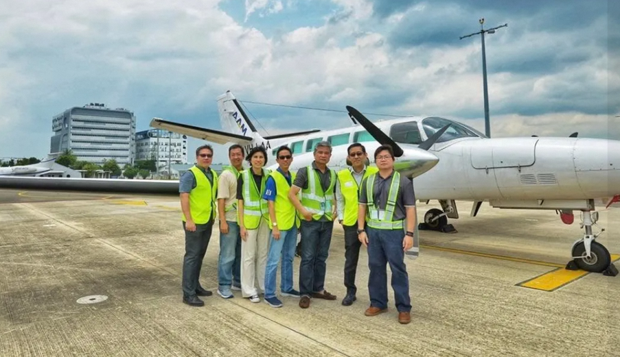
Survey & Geomatics team members with the aircraft used for the second aerial mapping exercise in 2019
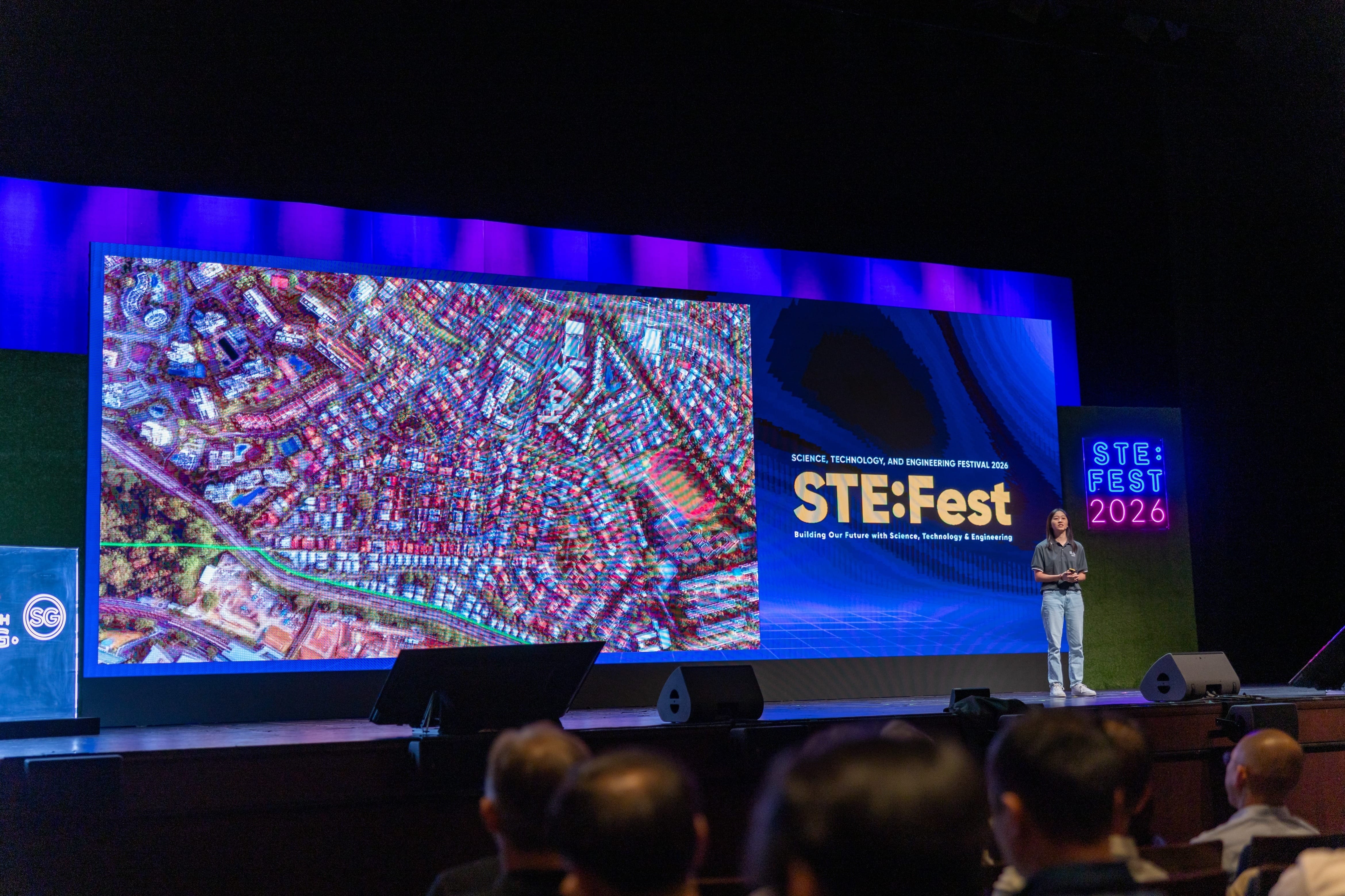
Chiok Pei Wen from Survey & Geomatics presenting the National 3D Mapping Programme at STE:Fest 2026
Did You Know?
The third aerial mapping exercise was conducted in March 2024 and was completed in September 2025 after 1.5 years. The exercise covered 98% of Singapore across 52 days, captured more than 18 billion points, over 130,000 images and more than 80TB of raw data.
We have mapped Singapore from above. What about what lies beneath?
Victor: Indeed, if 3D mapping was one of the defining challenges of the last decade, the underground mapping as one of the defining challenges of this one.
Singapore’s subsurface is extraordinarily complex. Water pipes, gas lines, electrical cables, telecommunications infrastructure, sewers and MRT tunnels all compete for limited space beneath a city that continues to grow.
Until recently, one of the main challenges was that there was no complete and consistently accurate picture of this subsurface environment. Data was held independently by different users — from government agencies to private utility operators — and often in different formats and at varying levels of accuracy.
When contractors excavate without reliable information about what lies below, the consequences can be serious. Apart from unnecessary costs and delays, there can be damage to utilities, service disruptions and, in the worst cases, safety incidents.
To address this, SLA collaborated with the Singapore-ETH Centre from 2017 to 2023 to develop an ecosystem for a reliable digital twin of Singapore’s subsurface utilities.
Across three phases, we progressed from trialling data-capture techniques such as Ground Penetrating Radar to developing the processes, technologies and community of practice needed to produce reliable 3D utility map data across the public and private sectors.
We continue to work with stakeholders to improve data quality and streamline workflows. More recently, SLA launched a centralised Utility Survey Submission Portal for the submission of as-built utility data, complemented by an enhanced coordination workflow with URA to help resolve potential underground conflicts before construction begins.
How might Singapore’s underground space evolve in the future?
Victor: There is still work to be done, and this is not a challenge any one organisation can solve alone. It requires agencies, utility operators, surveyors and industry to work together.
Looking further ahead, I expect Singapore to make much greater use of underground space — for logistics, storage, utilities and potentially commercial uses — driven by land scarcity and advances in construction technology.
The more intensively we use the underground, the more important it becomes to understand it accurately.
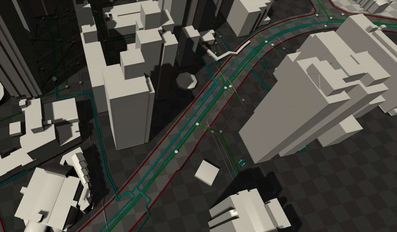
Impression of a 3D urban digital twin demonstrator utilising 3D data for infrastructure planning
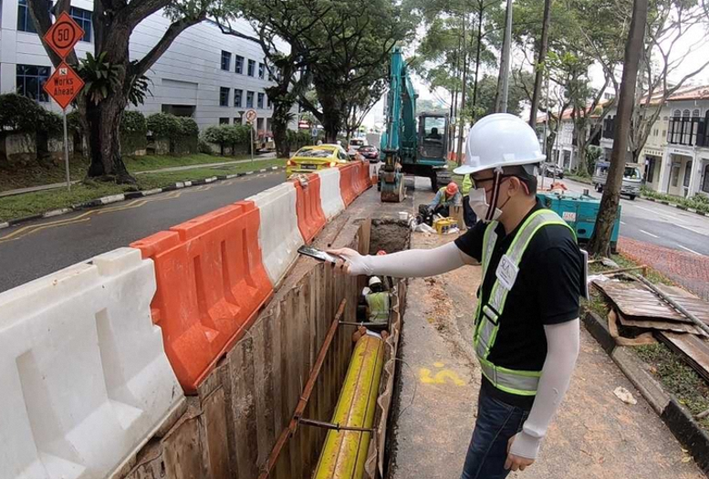
Application of new data capture technique for underground mapping
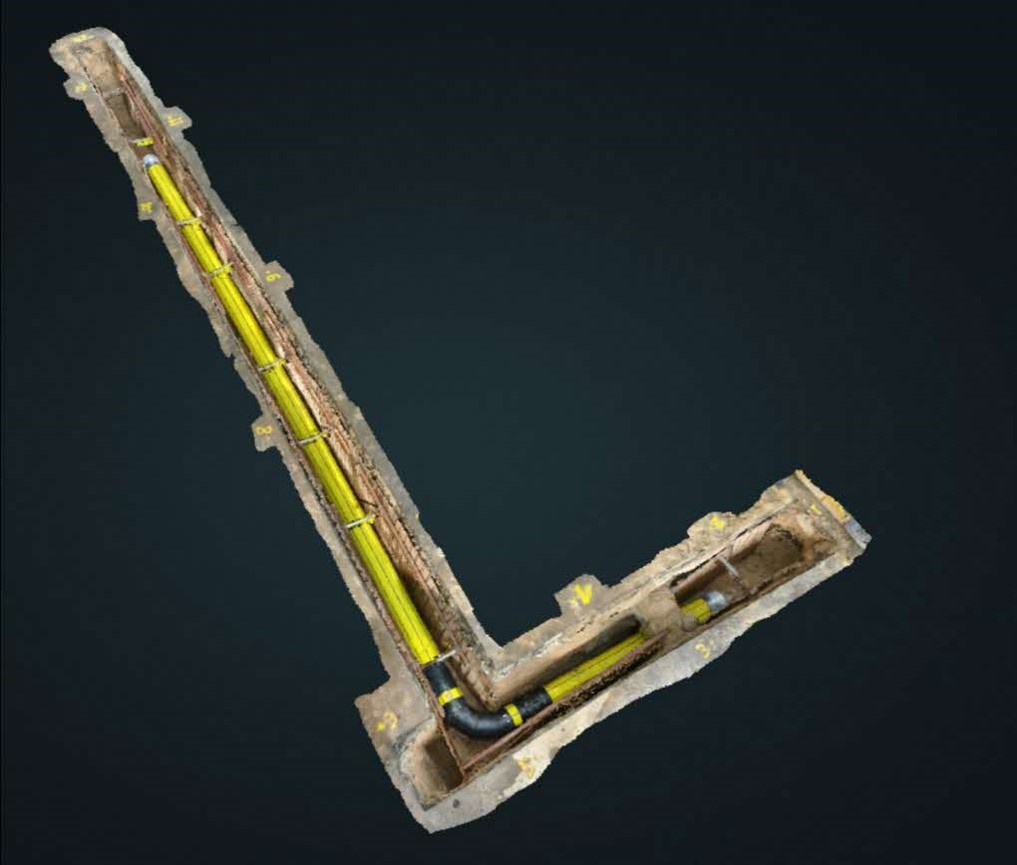
3D data capture of an underground pipe
What has working with other countries taught you about Singapore’s own journey?
Victor: It has reminded me not to take what we have built in Singapore for granted.
I have had the opportunity to contribute Singapore’s experience through several United Nations geospatial platforms, while learning from how other countries approach their own land administration and geospatial challenges.
Since 2022, I have been involved with the UN Expert Group on Land Administration and Management, including serving as Co-Chair. I also contribute to the UN-GGIM Asia-Pacific Regional Group and the United Nations Global Geodetic Centre of Excellence.
Through these platforms, we share Singapore’s experience in areas such as cadastral digital transformation, GNSS infrastructure, 3D mapping and underground space management. We also contribute practical applications of geospatial technology in areas such as coastal protection, solar deployment and carbon estimation.
For me, however, these engagements are as much about learning as sharing. Some of the conversations that have stayed with me most are with colleagues from developing countries who are building land registration systems from scratch, or dealing with inadequate boundary information in post-conflict environments.
Those conversations put our own work in perspective. They remind me that land administration is not simply a technical matter. Behind every boundary and land record are people. Ultimately, it is about their security, livelihoods and rights.

Director of Survey & Geomatics Dr Victor Khoo at the UNGGIM Asia Pacific Executive Board Meeting held in New Delhi on 27 April 2026
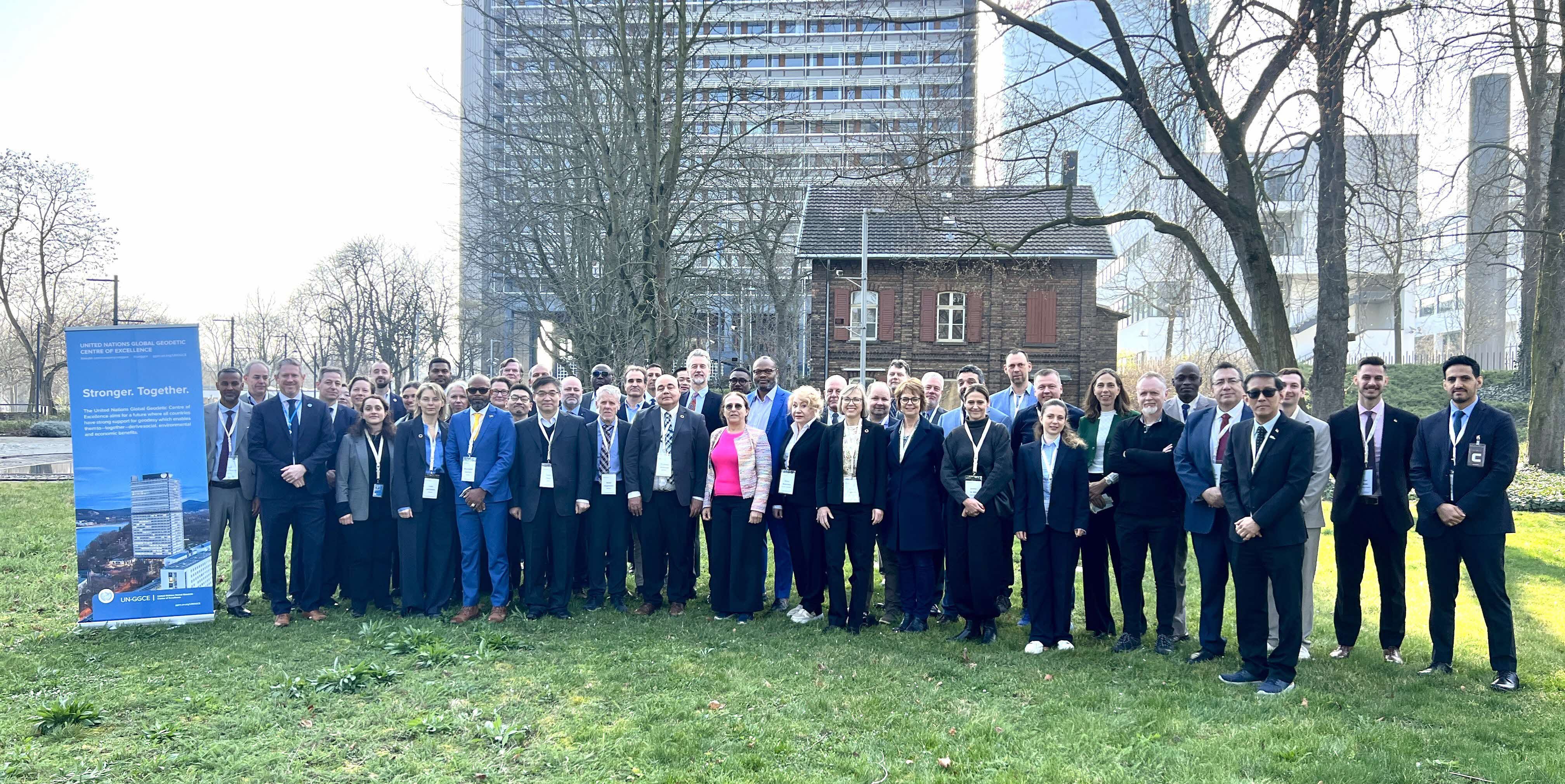
Dr Victor Khoo attended the 4th meeting of the UN-GGCE International Advisory Committee, held in UN Campus, Bonn, on 9 March 2026
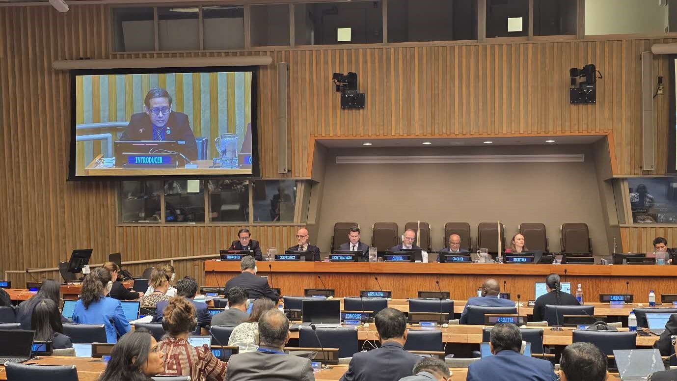
Dr Victor Khoo represented Singapore for the 15th session of United Nations Global Geospatial Information Management (UN-GGIM) held at the United Nations Headquarters, New York, on 7 August 2025
What will the surveyor of the future look like?
Victor: The tools will certainly change, but I do not think the fundamentals will. A surveyor will still need professional judgement, an understanding of the land and a strong sense of responsibility for the information we put on record. What technology can do is give us better tools to carry out that responsibility.
GEOAI — Geospatial and Earth Observation AI — will be an important part of that future.
Today, AI can already identify buildings, roads and vegetation from satellite and aerial imagery, and help extract map information from very large volumes of images. But I think it is important to be clear about its role. AI should augment the surveyor, not replace the surveyor.
It can help us process information faster and more accurately, automate repetitive work and enable professionals to take on larger and more complex projects. But professional judgement, accountability and an understanding of the land remain essential.
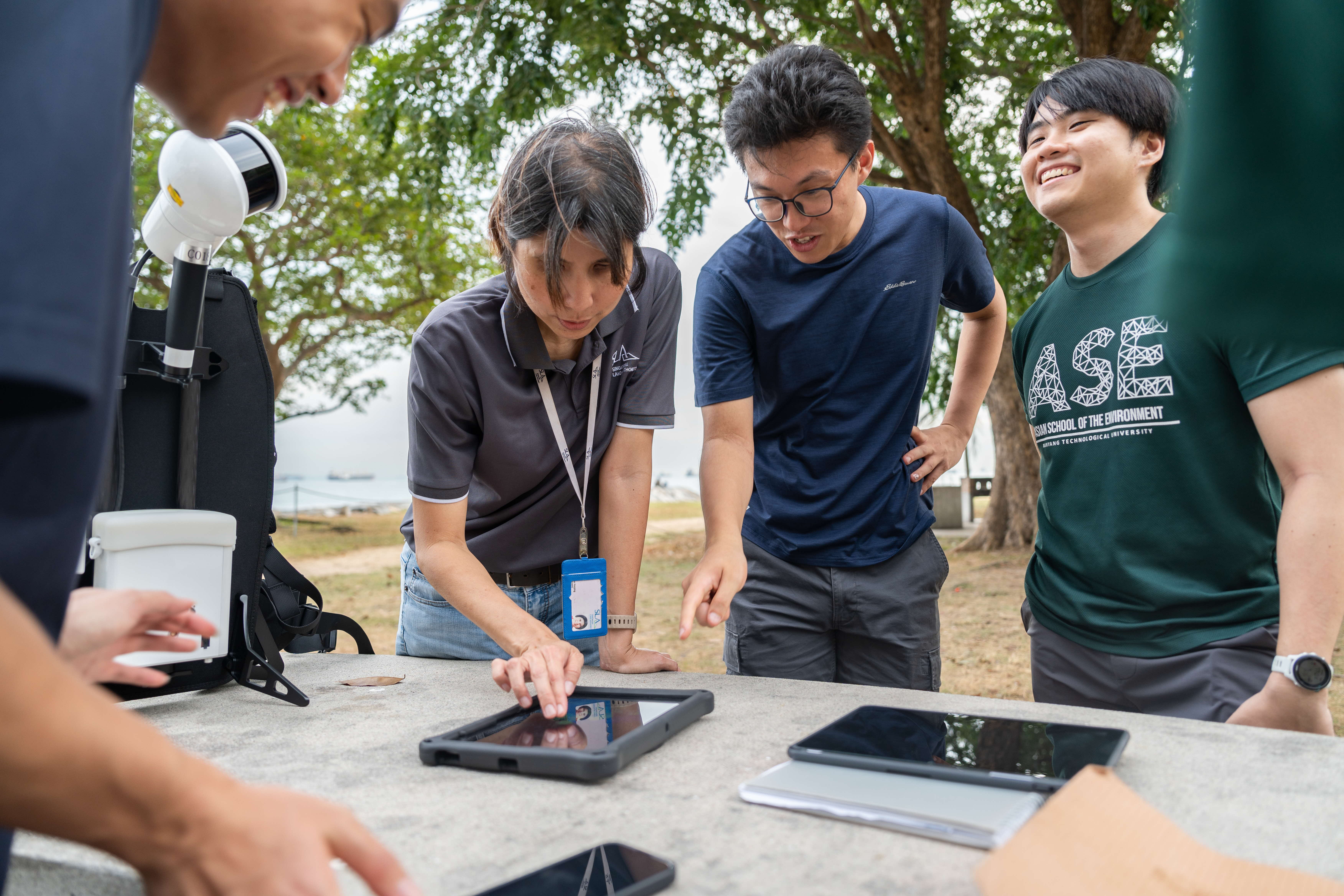
Part of the goal is also to develop capabilities in geospatial - SLA engaged a group of students from NTU on a 1-day hands-on course on geodesy at East Coast Park
My broader ambition is for SLA to become Singapore’s lead agency in GEOAI. By building these capabilities, we can accelerate updates to our national geospatial databases and digital twins, automate the generation of geospatial intelligence, and monitor changes to our land and environment more continuously.
This would strengthen SLA’s role as Singapore’s national geospatial and mapping agency while improving our ability to capture, create and maintain authoritative geospatial information and infrastructure.
Technology will continue to change the way we work, just as surveying itself has evolved dramatically since Singapore’s earliest maps. What should remain constant is our responsibility to provide information that people can trust.
For me, that is ultimately what the work is about: building and maintaining the geospatial foundations that help Singapore plan with confidence today, while preparing for what comes next.
#SLAExplains is a thought leadership series where SLA senior management breaks down complex land and geospatial concepts into accessible insights for the public. The series reflects SLA's commitment to transparency and public education, helping Singaporeans better understand the systems and policies that shape our nation's development.