
|
Home >
Settings >
Archives >
February 2022 >
Meet a GeoTech: OneSky
Meet a GeoTech: OneSky
In our “Meet a GeoWorks’ GeoTech” series, Pelwinderpal Singh from OneSky Systems, a global UAS traffic management (UTM) company, spoke to us about how geospatial technology has helped them in their work and the skills needed to work in the geospatial industry.
1. Tell us about your company and its solutions.
OneSky is a global UAS traffic management (UTM) company developing airspace assessment, operations, and management solutions for the aviation industry. We take a robust and long-term approach to UTM, envisioning the challenges ahead as traffic management is unified for all operators. By working with all stakeholders – unmanned aerial systems (UAS)/urban air mobility (UAM) operators, UAS/UAM manufacturers, and airspace authorities - we understand the evolving needs of this unique ecosystem and serve the long-term needs of the community.
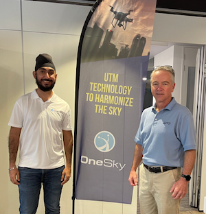
Pelwinderpal Singh, Manager, ASEAN, OneSky Systems (left) with Robert Hammett, CEO, OneSky Systems (right).
OneSky has proven its technology in numerous UTM programmes globally, including projects with the FAA, NASA, and Northeast UAS Airspace Integration Research (NUAIR). OneSky supports NASA’s AAM Grand Challenge. OneSky has partnered with companies and air navigation service providers (ANSPs) in Switzerland, Singapore, Japan, South Korea, and Australia to deploy UTM solutions.
OneSky is an ISO 27001 and GDPR compliant organisation, delivering cyber secure and data protected solutions.
Our key solutions include Modelling and Simulation Analytics, Operations Centre, and UTM. Our standard analytical services are used across our OneSky products. At OneSky, we have solutions for every step of the way. Our solutions support design and validation, testing and certification, and operations.
2. What is something about your company that the general public might not know about?
Many initially regard OneSky as a start-up. However, this is a misconception.
OneSky was formed as a business unit of Analytical Graphics, Inc. (AGI) in 2015. We have leveraged mature and sophisticated technology developed over 30 years and proven daily in advanced operations from ground-up to deep space to address the unique needs of UAS and UAM operations. These include over 7 million lines of aerospace-grade code and proven AGI enterprise air operations centre technology deployed to the U.S. Air Force and U.S. Navy.
In 2019, our traction in the market and evolution of our UTM technology led to OneSky spinning out from AGI. In 2020, we completed our Series A funding round with Sumitomo Corporation, a global trading and business investment company with a long-term commitment to the Advanced Air Mobility market.
OneSky looks forward to expanding its partnerships within the UAS and UAM ecosystem to harmonize the sky for new and future airspace operators.
3. What are some challenges you have faced in your work?
One key challenge we have faced as a UTM solutions provider is that many Civil Aviation Authorities (CAAs) or ANSPs are still working to develop their respective rules and regulations for the beyond visual line of sight (BVLOS) flights or are still in the midst of it. With this, many drone operations are not allowed to be commercialised, and existing operation permits for BVLOS flights take a long time to be approved.

Modelling and Simulation Tool STK
However, in recent years, several countries have seen the benefits UTM can deliver to enable safe and efficient traffic management. They have started to trial systems in small projects and at test ranges before expanding to broader BVLOS operations.
OneSky has continued to follow the development progress of the latest UAS and UAM standards and regularly participates in pilot programmes and flight operations to ensure our system is up to date with the latest technological advancements. Through these efforts, we have solidified our position as a top UTM provider globally.
4. How has your experience with GeoWorks been?
We have only been at GeoWorks since the start of the year, but our experience has been amazing. The office has excellent facilities and is a perfect place to network and make connections. The GeoWorks staff have been extremely helpful in getting us settled. They have also assisted us tremendously in various ways, such as helping to promote our job vacancy in Singapore through their respective social channels. OneSky is looking forward to this exciting journey together with GeoWorks.
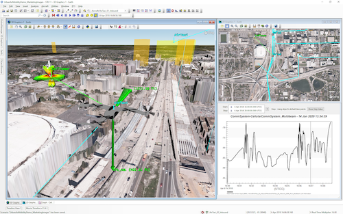
Modelling and Simulation Tool STK
5. How does geospatial technology help you in your work?
Geospatial technology is a critical piece for our modelling and simulation and UTM solutions. We utilise this technology not only for visualisation but we also use it analytically to study communications, navigation, and surveillance which is a key part of UAS operations. OneSky leverages geospatial technology from its sister company Cesium, which also spun out from AGI. With this technology, we can create a complete situational awareness tool that will allow us to safely and efficiently manage UAS and UAM traffic.
6. Are there any challenges that come with working with geospatial technology?
One challenge when it comes to working with geospatial technologies is the huge size of most datasets. Sometimes it can be extremely difficult to use large datasets with a high level of detail for most tasks as it will tremendously slow down the system. At OneSky, we utilise globally recognised standards such as OGC and technology solutions from our sister company Cesium that allows us to stream large amounts of data onto our system. This allows us to create a full situational awareness tool to a high level of fidelity.
Another challenge is that these datasets are extremely expensive. At OneSky, we recognise this problem and have partnered with various geospatial companies to provide solutions. One such example is our partnership with AAM for a UAS Aeronautical Information Management (U-AIM) scoping project in Australia for Air Services Australia.
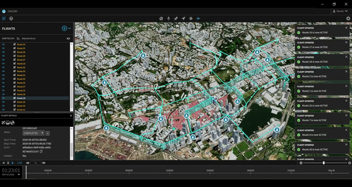 OneSky UTM
|
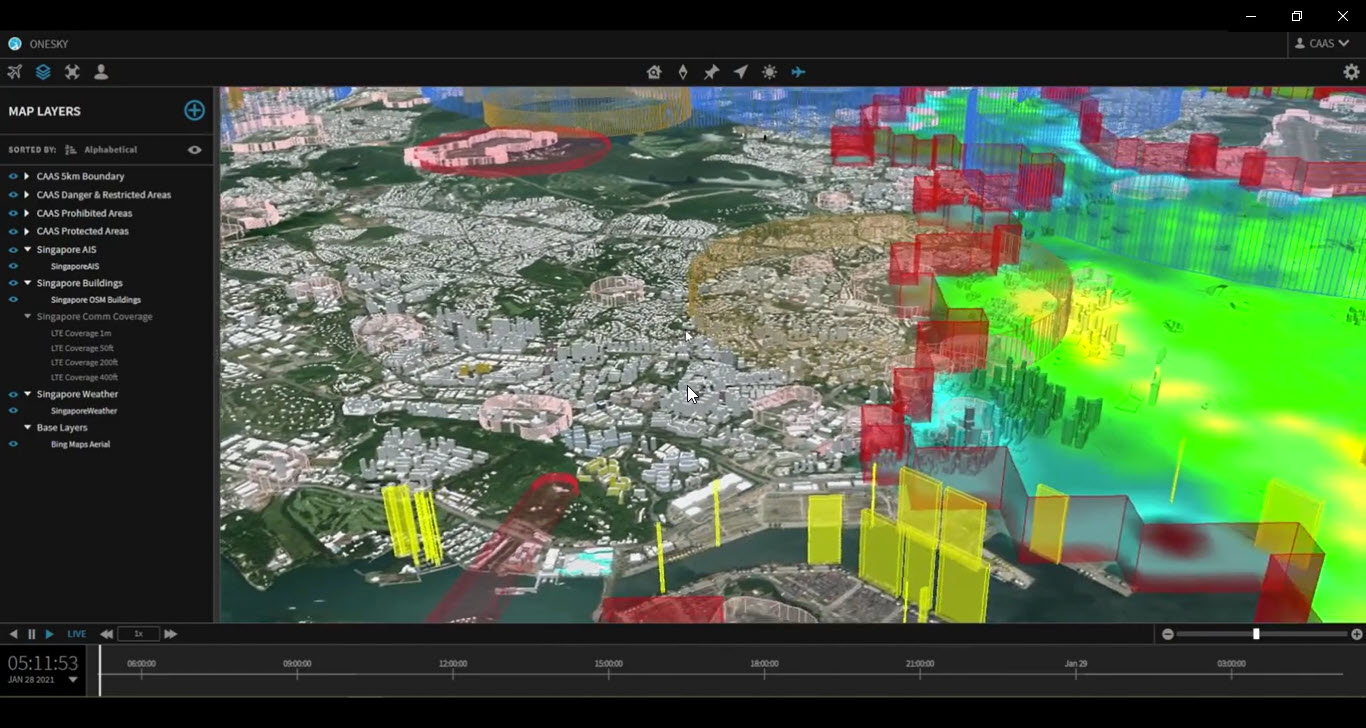 OneSky UTM
|
7. In your opinion, what skills are needed to work in the geospatial industry?
In the geospatial industry, one skill that is extremely important is analytical and critical thinking. It is essential to understand the dataset and its respective metadata. This will allow us to easily manipulate the data for whichever use case we need. Together with this, basic programming knowledge will help to automate processes. There are many formats for geospatial data, and sometimes it is essential to write code to help convert data from one form to another. An “always learning" mindset is also important. There are new formats and ways to make use of data more efficiently being introduced daily. Thus, it is essential to keep up to date with these advancements and learn how to utilise them to aid in work.
8. Do you have any advice for aspiring entrepreneurs?
If you have a passion for something and believe strongly in it, give your best in it and don’t give up. Failure is common but what separates winners from the rest is their ability to learn from their experiences and pick themselves up quickly.